What Does Terlingua Mean? Three Tongues or a Lost Word
Nobody's sure. The Handbook of Texas says most sources call Terlingua a corruption of the Spanish tres lenguas, 'three tongues,' for either the three forks of Terlingua Creek or three languages spoken by the Apache, Comanche and Shawnee who lived along it. Another story holds that it's an old Indian name whose meaning has been lost.
Terlingua, Texas, got its name from a creek and a Mexican village, and the name moved twice before it landed at the mining camp you can visit today. What the word means is the part nobody has pinned down.
Three tongues, or a word nobody remembers
The Handbook of Texas takes up the question in its entry on Terlingua Creek, not the town. Here’s the whole passage:
“Most sources state that the name Terlingua is a corruption of the Spanish tres lenguas, meaning ‘three tongues,’ either for the three forks of the creek or for the three languages spoken by the Apache, Comanche, and Shawnee Indians who lived along the creek. Another story, however, holds that Terlingua is an old Indian name, the meaning of which has been lost.”
So there are really three explanations packed in there. Two of them start from tres lenguas and disagree about what the “tongues” were: branches of a creek, or languages. The third says the word isn’t Spanish at all. The Handbook doesn’t pick one, and its own wording, “most sources state” and “another story,” keeps its distance from all three.
The creek itself is a long one. The same entry says it’s formed where Paradise and Hackberry draws meet and runs 83 miles (134 km) to the Rio Grande, coming out just east of Santa Elena Canyon. One source the Handbook cites puts Spanish-speaking settlers on the creek’s lower stretch perhaps as early as 1800, and for sure by 1859, the year an Army expedition led by Lt. Edward L. Hartz came through.
Three places called Terlingua
Here’s where it gets confusing. Kenneth B. Ragsdale’s Handbook entry on the town opens with it: “The name Terlingua has been applied to three different settlements in southwestern Brewster County.”
- The original Terlingua was a Mexican village on Terlingua Creek, three miles (5 km) above where it meets the Rio Grande.
- The Marfa and Mariposa camp. When quicksilver turned up in the mid-1880s, Ragsdale writes, the Marfa and Mariposa mining camp “became known as Terlingua,” and the old village became Terlingua Abaja, or lower Terlingua. A post office called Terlingua opened in 1899.
- The Chisos camp. Howard E. Perry, a Chicago industrialist, started the Chisos Mining Company in 1903. When the Marfa and Mariposa mine closed in May 1910, the post office moved ten miles (16 km) east to the Chisos camp, and “the name was retained.”
The creek entry tells it a little differently. It says the Chisos’s mining town took the Terlingua name after the company started up in 1903, about eight miles (13 km) north of the old village, without mentioning the post office move. Either way, the name ended up at the Chisos camp, which is the Terlingua that’s still there.
Borrowing an older settlement’s name for a new mining camp happened elsewhere, too. In New Mexico, the coal camp of Keeseville became Madrid in 1892, taking the name of an earlier Spanish settlement.
Quicksilver, a ghost town and chili
The Chisos camp did well. Ragsdale says that by 1913 Terlingua had about 1,000 people, with a company store, a hotel and a doctor, and that by 1922 it produced 40 percent of the quicksilver mined in the United States. The mule-drawn wagons that hauled it went to the railroad at Alpine and Marathon, the Chisos entry adds. Then production dropped, the company filed for bankruptcy on October 1, 1942, and after World War II most people left. “Terlingua became a ghost town,” Ragsdale writes.
Tourism brought it back. The Park Service, which describes Terlingua and Study Butte as sitting just outside the western entrance to Big Bend National Park in Texas, notes that in 1967 the Chili Appreciation Society named Terlingua the “Chili Capitol of the World,” spelled that way.
Cincinnati, Ohio, has a three-language story of a different kind. Its first name, Losantiville, was built by John Filson out of Latin, Greek and French pieces, according to Henry Howe’s history of Ohio.
Terlingua on the 1904 map
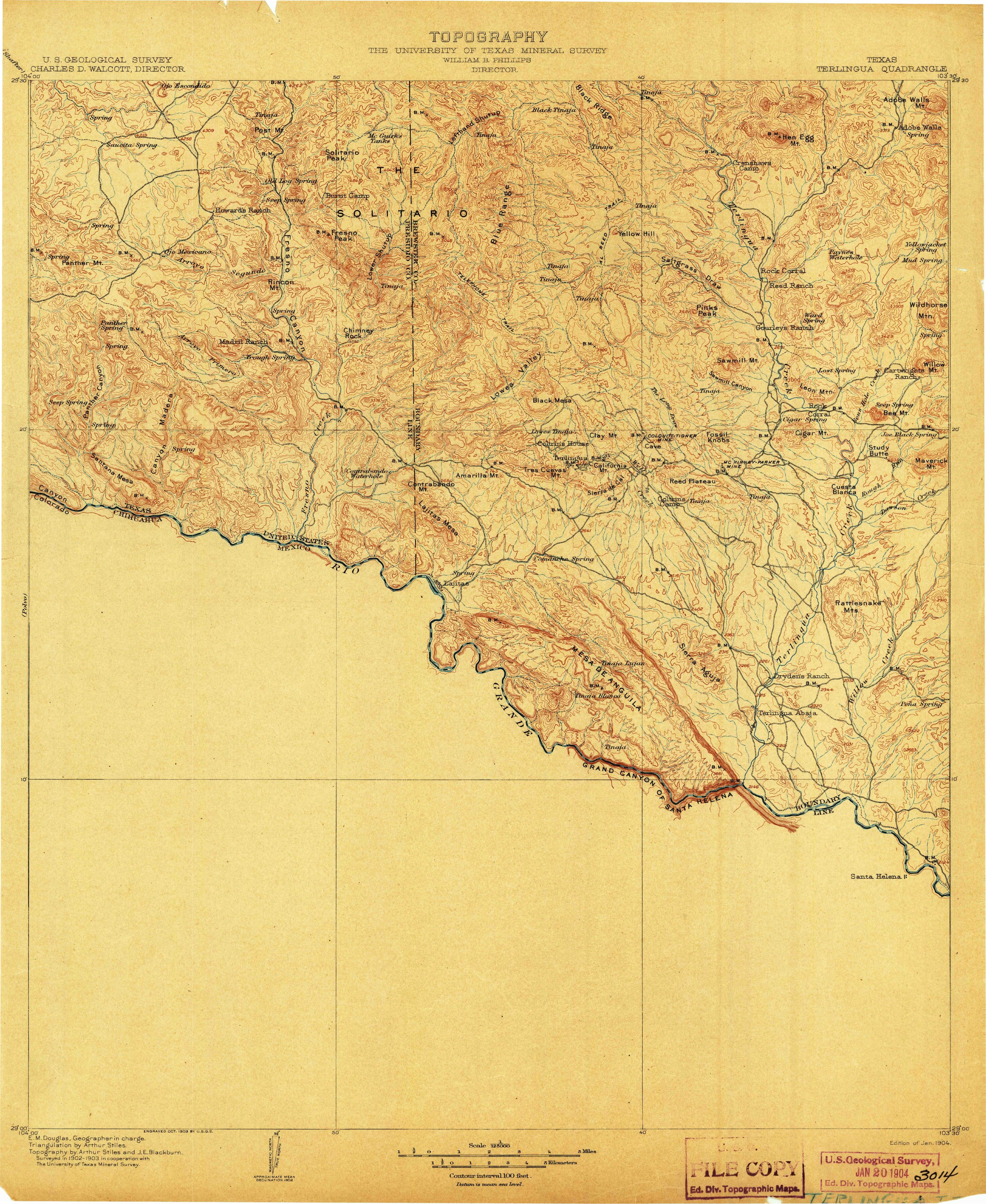
The map at the top is from the Terlingua quadrangle, surveyed in 1902–1903 by the U.S. Geological Survey “in cooperation with The University of Texas Mineral Survey.” The margin names Charles D. Walcott as the Survey’s director and William B. Phillips as director of the Mineral Survey, with E. M. Douglas as geographer in charge and topography by Arthur Stiles and J. E. Blackburn. It was “Engraved Oct. 1903,” and this copy is the “Edition of Jan. 1904,” stamped by the Survey on January 20, 1904, with no later printing line.
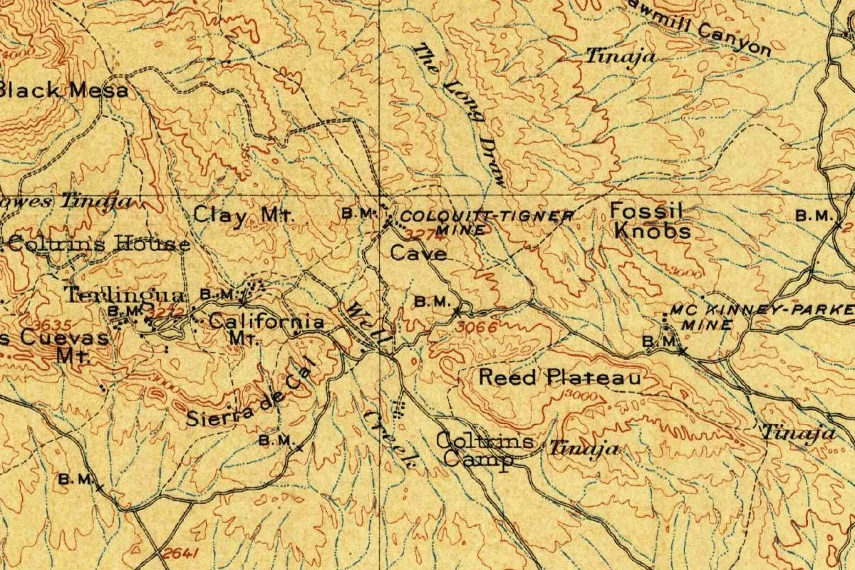
The map catches the name in the middle of its travels. The settlement it labels Terlingua sits next to California Mt, and by Ragsdale’s timeline, in 1904 that name belonged to the Marfa and Mariposa camp. Farther south on the full sheet, it prints “Terlingua Abaja.” Near the spot where the national names database puts today’s town, the crop shows the McKinney-Parker Mine rather than a town name. You’ll also see the Colquitt-Tigner Mine, Clay Mt, Black Mesa, Tres Cuevas Mt, Reed Plateau and Fossil Knobs.
Quick answers
What does Terlingua mean?
Nobody knows for certain. Most sources, the Handbook of Texas says, call it a corruption of tres lenguas, “three tongues,” for three creek forks or three Indian languages. Another story says it’s an old Indian name whose meaning is lost.
Is Terlingua a Spanish word?
That depends on which story you follow. The tres lenguas explanation makes it Spanish; the other story in the Handbook makes it an Indian name.
Why are there two Terlinguas on old maps?
Because the name moved. The original Mexican village became Terlingua Abaja when the Marfa and Mariposa camp took the name, and in 1910 the post office moved to the Chisos camp, Ragsdale writes.
When did Terlingua become a ghost town?
After World War II. The Chisos Mining Company went bankrupt on October 1, 1942, and most of the people left when its successor shut down, the Handbook says.
Key dates
- 1859Spanish-speaking people are living on lower Terlingua Creek when Lt. Edward L. Hartz's expedition passes through, by the Handbook's account.
- 1899A Terlingua post office is established.
- 1903Howard E. Perry's Chisos Mining Company begins operations.
- 1904The Geological Survey's Terlingua quadrangle shows Terlingua and Terlingua Abaja.
- 1910The Marfa and Mariposa mine closes in May, and the post office moves ten miles (16 km) east to the Chisos camp, keeping its name.
- 1922Terlingua produces 40 percent of the quicksilver mined in the United States.
- 1942The Chisos Mining Company files for bankruptcy on October 1.
- 1967The Chili Appreciation Society calls Terlingua the 'Chili Capitol of the World.'
Things to do in Terlingua, Texas
Big Bend National Park
The national park whose western entrance sits just beyond Terlingua and Study Butte, with desert and mountain country, canyons on the Rio Grande and more than 150 miles (241 km) of trails.
Barton Warnock Visitor Center
The eastern entrance to Big Bend Ranch State Park, with exhibits on the cultural and natural history of the Chihuahuan Desert, a two-acre (0.8 ha) desert garden and park permits.
Big Bend Ranch State Park
The largest state park in Texas, stretching along the Rio Grande on the border with Mexico, with rugged mountains, steep canyons and dark night skies, explored on foot, by bike, on horseback, by boat or by vehicle.
River Road (Highway 170)
The road along the Rio Grande between Lajitas and Presidio, which the state parks department says National Geographic ranks among the top 10 scenic drives in the country.
Getting there
Open Terlingua in Google Maps
Opens in a new tab. The pin is the center of Terlingua in the USGS place-name record.
The closest airports, Amtrak stations and intercity bus stops, measured in a straight line from the center of Terlingua.
Amtrak trains
- Alpine station (ALP) 72 mi 115 km
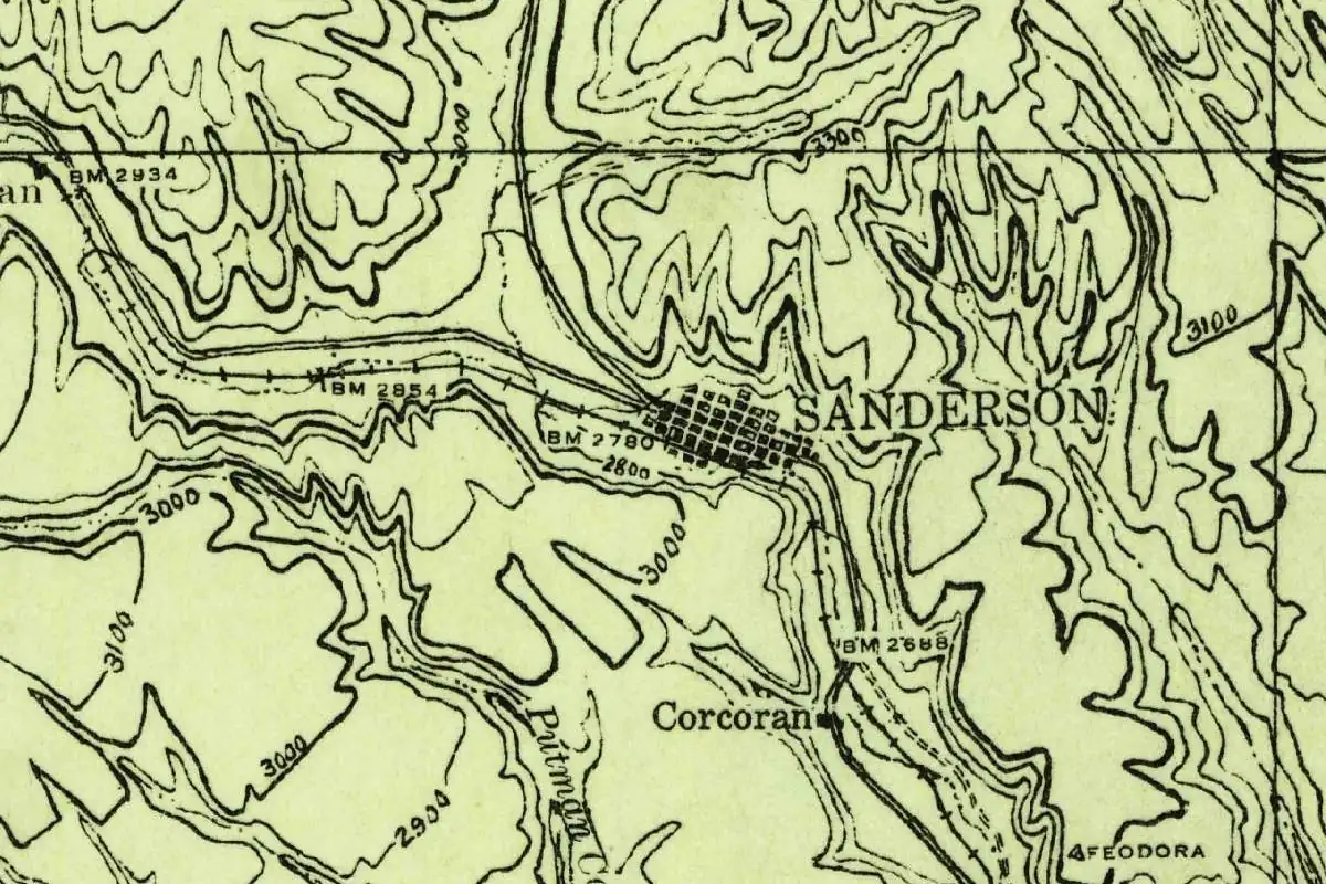
- Sanderson station (SND) 92 mi 149 km
Intercity buses
- All Aboard America Presidio 49 mi 78 km
Distances are as the crow flies, not by road. We don't list schedules or fares because they change; check with the airline, Amtrak or the bus company before you go. Official data (FAA commercial service airports (2025), FAA airport locations, Amtrak stations and Intercity Bus Atlas) from the FAA and the U.S. Bureau of Transportation Statistics, checked Nov 18, 2026.
Sponsored
Staying in Terlingua?
Compare hotels in Terlingua, Texas, on Expedia.
See hotels in TerlinguaWe may earn a commission if you buy through this link. It never changes what we write. Read our affiliate disclosure
Historical Sources & References
- Handbook of Texas, “Terlingua Creek”. “Most sources state that the name Terlingua is a corruption of the Spanish tres lenguas,” the three forks or three languages, the “old Indian name,” the creek’s course, Hartz’s expedition of 1859 and the Terlingua name moving to the Chisos’s town.
- Kenneth B. Ragsdale, “Terlingua, TX,” Handbook of Texas. The three settlements, the Marfa and Mariposa camp, Terlingua Abaja, the post office of 1899 and its move in 1910, the 40 percent of 1922, the bankruptcy of 1942, the ghost town and the “Chili Capitol.”
- Kenneth B. Ragsdale, “Chisos Mining Company,” Handbook of Texas. Howard E. Perry, the start in 1903, the wagons to Alpine and Marathon.
- National Park Service, “Study Butte and Terlingua”. The location outside Big Bend’s western entrance, quicksilver mining and the 1967 “Chili Capitol of the World.”
- Big Bend National Park; Barton Warnock Visitor Center; Big Bend Ranch State Park. The details in the things-to-do list.
- U.S. Geological Survey, GNIS feature 1379150. Where the national names database puts the town, in Brewster County.
- Terlingua quadrangle, surveyed 1902–03, edition of January 1904. The sheet the map at the top was cropped from.
Sponsored
Put this 1904 map on your wall
The 1904 Terlingua quadrangle, surveyed in 1902-03 by the Geological Survey with the University of Texas Mineral Survey, is in the public domain. Download the full-size scan for free, then have it printed on canvas with CanvasOnTheCheap.
Print a map on canvasDownload the full-size mapWe may earn a commission if you buy through this link. It never changes what we write. Read our affiliate disclosure
Spot something wrong, or know more? Tell us here. You can also email us or use our contact page. Corrections are noted here with their date, never made silently.