Fort Davis, Texas: A Post Named for the Secretary of War
Fort Davis takes its name from the Army post beside it. Gen. Persifor F. Smith chose the site, and his order of October 23, 1854, established the fort and named it for Jefferson Davis, then Secretary of War, the National Park Service says. That was years before the Civil War, which broke out in 1861.
Fort Davis, Texas, grew up beside an Army post that Gen. Persifor F. Smith named in 1854 for the Secretary of War, Jefferson Davis. The town took the fort’s name, and so, in time, did the county around it.
The general’s order of 1854
The National Park Service, which runs the old post today, tells it plainly: “On October 23, 1854, General Persifor F. Smith, in command of the Department of Texas, issued the order officially establishing Fort Davis. Smith, who had personally selected the site, named it in honor of the Secretary of War, Jefferson Davis.”
Martin Donell Kohout’s entry on Jeff Davis County in the Handbook of Texas gives the same date: “On October 23 the order establishing Fort Davis, named for Secretary of War Jefferson Davis, was issued.” Lt. Col. Washington Seawell and his troops had reached Limpia Creek on October 3, the entry says, and four days later started building at a site Smith had picked.
So when the post got its name, Davis was running the War Department. The Civil War didn’t break out until the spring of 1861, the park service notes, and that’s when federal troops pulled out and Texas Confederates moved in.
There was a problem with the land, too. The Army thought it was building on state land, but it turned out to belong to John James, whom the park service calls “a San Antonio surveyor” and the Handbook calls “a San Antonio land speculator.” The Army leased it from him.
A canyon on the road to El Paso
Lt. Zenas R. Bliss of the Eighth Infantry got there in October 1855, 17 days after boarding the westbound stage in San Antonio. “The Post was the most beautifully situated of any that I have ever seen,” he later wrote. “It was in a narrow canyon with perpendicular sides, the walls of which were about 200 feet in height.” That’s about 61 meters.
The point of the place was the road. The park service puts the fort some 400 miles (about 640 km) from San Antonio and 200 miles (about 320 km) from Franklin, which is present-day El Paso, guarding travelers on the San Antonio-El Paso Road.
Davis’s name turns up a second time in the fort’s story. In 1855 the Army started bringing camels from the Middle East to haul supplies to posts like this one, and the park service calls the “camel experiments” ones that were “championed by Jefferson Davis.” Lt. Edward Beale and his camels passed through Fort Davis in the summer of 1857. A year earlier, a herd had crossed Bandera Pass on its way to Camp Verde, as you’ll read in our story on Bandera.
Davis’s War Department reached far beyond Texas, too. Frank Hall’s 1895 History of the State of Colorado says that “Jefferson Davis, then Secretary of War,” ordered the 1853 railroad survey led by Capt. J. W. Gunnison, the man behind the name of Gunnison, Colorado.
A settlement called Chihuahua
The town didn’t start out as Fort Davis. Kohout’s Handbook entry on the town says that “The precursor of the town was a rough-and-tumble settlement known as Chihuahua, which formed just southwest of the military post.” The fort itself stood where an Indian village had been, a spot early Anglo-American explorers called Painted Comanche Camp.
The post sat empty from September 1862 to June 1867. Once troops came back, the town became “the most important town in the Trans-Pecos country,” Kohout writes. Fort Collins grew out of the Army’s Camp Collins, and Fort Wayne, Indiana, carries the name of a fort raised in 1794.
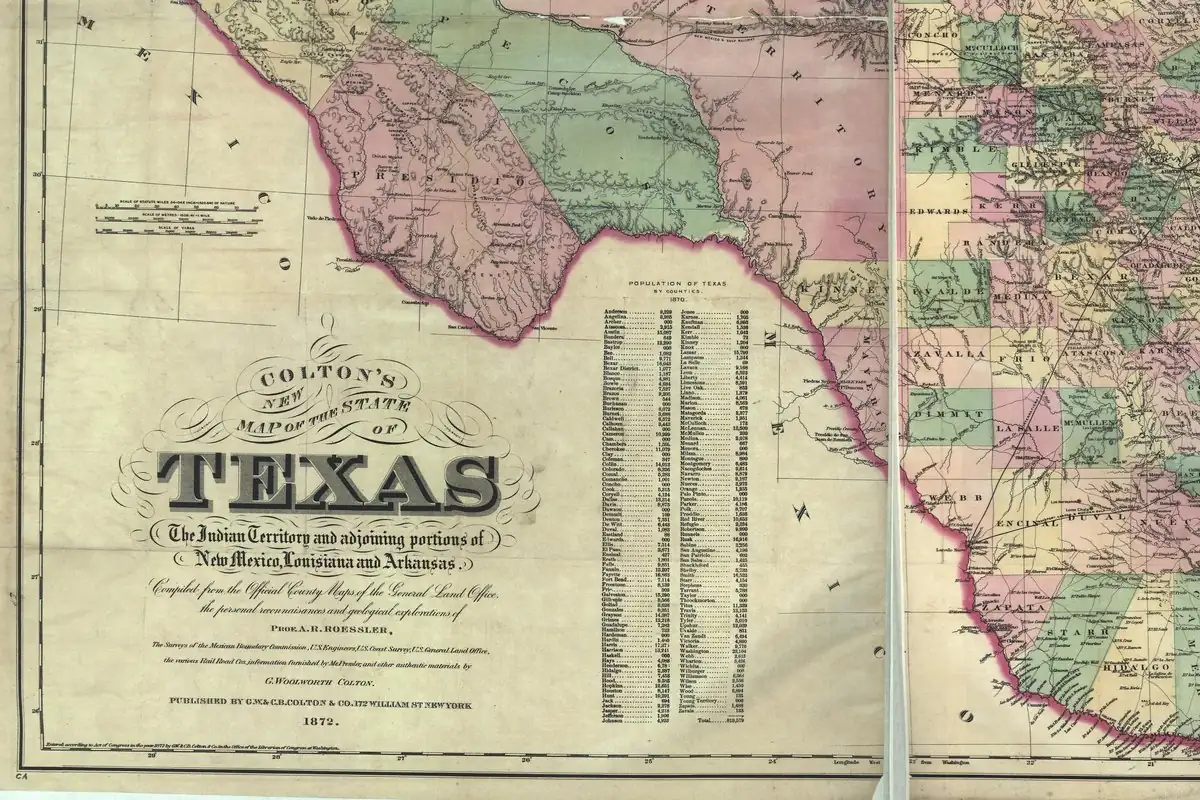
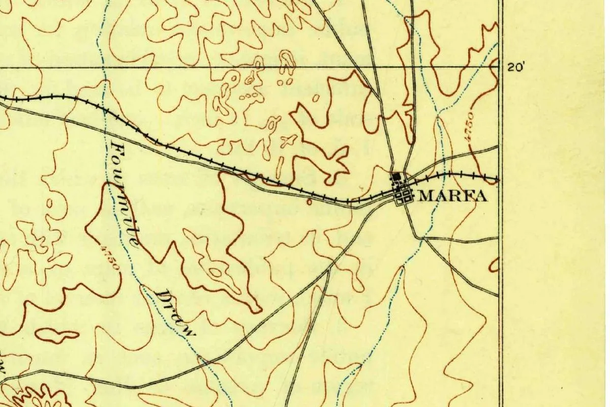
When Presidio County was organized in April 1871, Fort Davis was its seat. Then the Southern Pacific came through Marfa, and in a July 1885 election Marfa took the county seat away. The losing side pushed for a county of its own. The Texas legislature created Jeff Davis County on March 15, 1887, with Fort Davis as its seat. Gannett (1905) gives it a single line: “Jeff Davis; county in Texas, named for Jefferson Davis.” The creek through town has a Spanish name of its own, Limpia, which the county entry glosses as “Spanish for ‘clean.’”
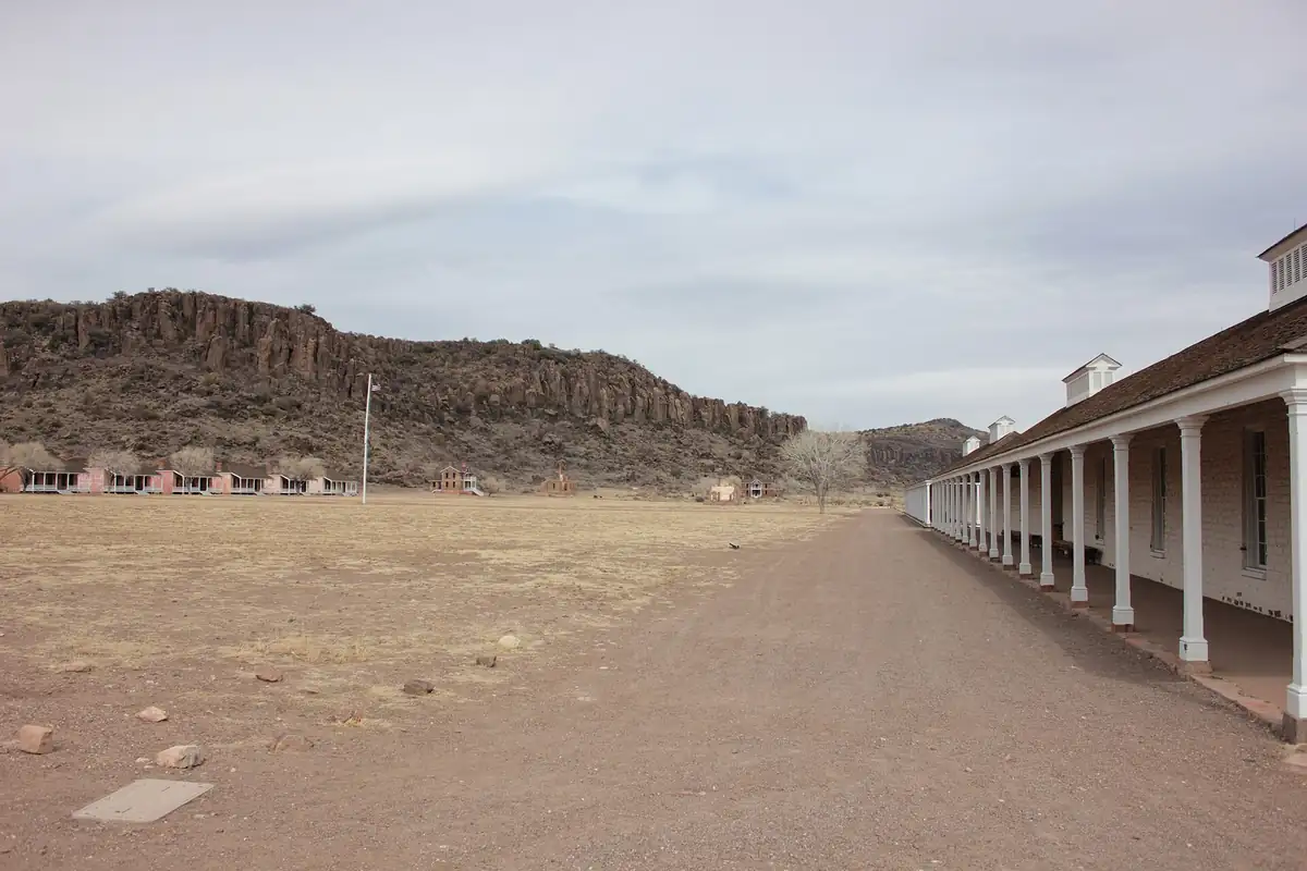
The Army abandoned the fort in 1891, and the National Historic Site came into being in September 1961. The photo below looks across its parade ground.
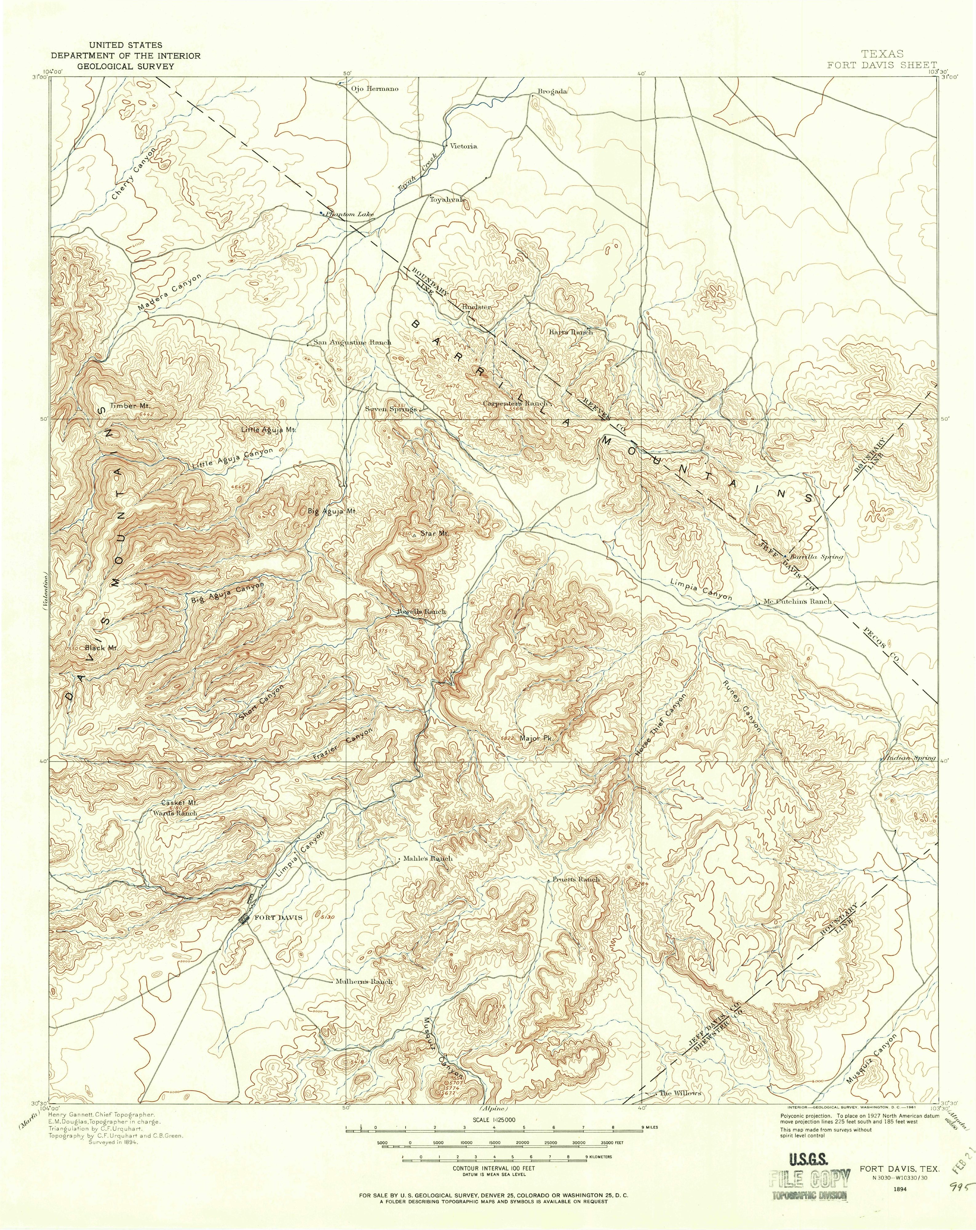
Gannett’s name on the 1894 map
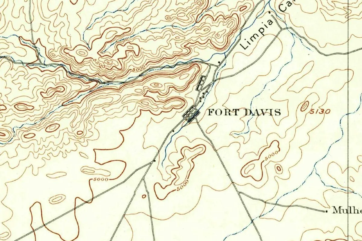
The map at the top of this page is a detail from the Geological Survey’s Fort Davis sheet, surveyed in 1894. The copy shown is a later printing, dated 1961 in the margin. If you read the fine print at the bottom of the full sheet, you’ll find a familiar name: “Henry Gannett, Chief Topographer,” with E. M. Douglas as topographer in charge and the topography by C. F. Urquhart and C. B. Green. The town is a small grid of blocks beside a stream, with the name of Limpia Canyon running off the top edge.
Quick answers
Who is Fort Davis, Texas, named after?
Jefferson Davis, by way of the fort. Gen. Persifor F. Smith named the post for Davis, then Secretary of War, in his order of October 23, 1854, the National Park Service says. The town grew up beside it.
Was Davis Secretary of War when the fort was named?
Yes. The fort was named in 1854, when Davis was Secretary of War, and the Civil War didn’t break out until 1861, the park service says. Jeff Davis County, created in 1887, is also named for Jefferson Davis, Gannett says.
What was Fort Davis called before?
Chihuahua, in a sense. The Handbook of Texas says the town’s “precursor” was a settlement known as Chihuahua, just southwest of the post. The fort stood on a site explorers called Painted Comanche Camp.
Key dates
- 1854On October 23, Gen. Persifor F. Smith's order establishes Fort Davis, named for Secretary of War Jefferson Davis.
- 1855Lt. Zenas R. Bliss reaches the post and describes its canyon walls, about 200 feet (61 m) high.
- 1857Lt. Edward Beale and the Army's camels pass through Fort Davis in the summer.
- 1862The post is abandoned in September and stays empty until June 1867.
- 1871Presidio County is organized in April with Fort Davis as its seat.
- 1885Marfa wins a new county-seat election in July.
- 1887The legislature creates Jeff Davis County on March 15, with Fort Davis as its seat.
- 1891The Army abandons the fort.
- 1961Fort Davis National Historic Site comes into being in September.
Things to do in Fort Davis, Texas
Fort Davis National Historic Site
Start at the visitor center and museum with a 15-minute video on the fort's history, then take a self-guided tour of five buildings restored and refurnished to the 1880s, or explore the other 100 ruins and foundations. A recorded 1875 dress retreat parade plays across the grounds.
Davis Mountains State Park
A mountain park with the 4.5-mile (7.2 km) Skyline Drive Trail and a 1.75-mile (2.8 km) CCC trail that connects with a trail to the national historic site. The CCC built the park's five-mile (8 km) Skyline Drive and Indian Lodge, a historic 39-room motel.
Scenic Loop Drive
A 75-mile (121 km) loop drive through the Davis Mountains that begins and ends in Fort Davis, listed by the state park among the things to see near town.
Chihuahuan Desert Research Institute
Hiking trails in the foothills of the Davis Mountains at 5,100 feet (1,554 m), plus 18 fenced acres (7.3 ha) of botanical gardens with a Pollinator Garden, the Maxie Templeton Cactus Museum and a Native Grasses Exhibit. There's also a Mining Exhibit and a Bird Blind.
Getting there
Open Fort Davis in Google Maps
Opens in a new tab. The pin is the center of Fort Davis in the USGS place-name record.
The closest airports, Amtrak stations and intercity bus stops, measured in a straight line from the center of Fort Davis.
Airports
- Midland International Air And Space Port (MAF) 137 mi 220 km
Amtrak trains
- Alpine station (ALP) 21 mi 34 km
- Sanderson station (SND) 94 mi 152 km
Intercity buses
- All Aboard America Marfa 21 mi 34 km
Distances are as the crow flies, not by road. We don't list schedules or fares because they change; check with the airline, Amtrak or the bus company before you go. Official data (FAA commercial service airports (2025), FAA airport locations, Amtrak stations and Intercity Bus Atlas) from the FAA and the U.S. Bureau of Transportation Statistics, checked Nov 17, 2026.
Sponsored
Staying in Fort Davis?
Compare hotels in Fort Davis, Texas, on Expedia.
See hotels in Fort DavisWe may earn a commission if you buy through this link. It never changes what we write. Read our affiliate disclosure
Historical Sources & References
- National Park Service, “The First Fort Davis: 1854-1862”. Smith’s order of October 23, 1854, and the name, Seawell, John James, Bliss’s 1855 description, the distances of about 400 miles (640 km) and 200 miles (320 km), the camels of 1857, the Civil War and the abandonment of 1862-1867.
- Martin Donell Kohout, “Fort Davis, TX,” Handbook of Texas Online. The settlement called Chihuahua, Painted Comanche Camp, the town after 1867, the county seat fights of 1871 and 1885, Jeff Davis County in 1887 and the National Historic Site in 1961.
- Martin Donell Kohout, “Jeff Davis County,” Handbook of Texas Online. The order of October 23 naming the fort for Davis, Seawell’s arrival at Limpia Creek on October 3, John James as a land speculator, Limpia as “Spanish for ‘clean’” and the Army’s departure in 1891.
- Henry Gannett, The Origin of Certain Place Names in the United States (1905), p. 168. Jeff Davis County, named for Jefferson Davis. Checked against the page image.
- Frank Hall, History of the State of Colorado, vol. 4 (1895), p. 144. Davis, “then Secretary of War,” ordering the 1853 survey led by Capt. J. W. Gunnison. Checked against the page image.
- Fort Davis National Historic Site; Davis Mountains State Park; Chihuahuan Desert Research Institute. The details in the things-to-do list.
- GNIS feature ID 1357584 (U.S. Geological Survey). Fort Davis in the national gazetteer, in Jeff Davis County, with its coordinates.
- U.S. Geological Survey, Fort Davis sheet (1894). The 1:125,000 sheet, in its 1961 printing, that the map at the top of this page was cropped from, with Gannett’s name in the margin.
Sponsored
Put this 1894 map on your wall
The Geological Survey's 1894 Fort Davis sheet (a 1961 printing) is in the public domain. Download the full-size scan for free, then have it printed on canvas with CanvasOnTheCheap.
Print a map on canvasDownload the full-size mapWe may earn a commission if you buy through this link. It never changes what we write. Read our affiliate disclosure
Spot something wrong, or know more? Tell us here. You can also email us or use our contact page. Corrections are noted here with their date, never made silently.