Gunnison, Colorado: The Captain From the 1853 Survey
Gunnison is named for Capt. J. W. Gunnison of the U.S. Topographical Engineers, Frank Hall's 1895 history says, and so are the county and its main river. He led an 1853 survey for a railroad route to the Pacific and was killed near Sevier Lake that October. He didn't found the town.
Gunnison, Colorado, carries the name of Capt. J. W. Gunnison, an Army engineer whose 1853 railroad survey crossed the region months before he was killed. The town came much later, and the captain had nothing to do with founding it.
A railroad survey in 1853
Frank Hall’s History of the State of Colorado, in its fourth volume, of 1895, calls Gunnison “The first explorer of whom we have any authentic record” in the county, “though he may have been preceded by some of the old guild of hunters and trappers.” Hall names him as “Capt. J. W. Gunnison of the U. S. Topographical Engineers, for whom the county, its capital and principal stream were named.”
The expedition, Hall writes, was authorized by an act of Congress approved March 3, 1853. “Soon afterward Jefferson Davis, then Secretary of War, directed that a survey be made to ascertain the most practicable and economical route for a railroad from the Mississippi river to the Pacific ocean.” The line was to cross the Rocky Mountains by way of the Huerfano and Cochetopa, “or some other practicable pass.” The party left the Missouri River on June 17, 1853. “Capt. Gunnison was killed by Indians at his camp near Sevier lake, October 26th following,” Hall says, and Lt. E. G. Beckwith finished the survey and wrote the report.
The same Secretary of War turns up in Texas the next year, when an Army post was named for him. That story is in our article on Fort Davis.
By 1905 the captain’s name had spread well past this valley. Gannett counts them: “Gunnison; county, town in same county, mountain, and river in Colorado, and island in Great Salt Lake, Utah, named for Capt. J. W. Gunnison, an early explorer.” That lake also gave Salt Lake City its name.
Cattle cabins and a colony
The first buildings weren’t a town at all. Hall says the Los Pinos Indian agency kept its cattle camp “near the present site of Gunnison City,” because the grazing was good. Alonzo Hartman put up the first cabin there. “I came to Gunnison December 25, 1872, from the Los Pinos agency in Saguache county,” reads Hartman’s statement in Hall’s book. The government had 1,000 cattle and as many sheep at the cow camp cabins, which he placed “a mile below the present town of Gunnison.” That’s about 1.6 km.
Next came a colony. It was organized in Denver in the winter of 1873-74, with Prof. Sylvester Richardson as president, and Richardson’s own account is short: “We went to Gunnison in April, 1874, and located the town, built roads, bridges, etc. Shortly after the arrival of the colony it disbanded, some remaining at Gunnison as ranchmen, others going to the mountains to prospect for mineral.” Miners and stockmen followed. “In 1876 an excitement occurred which built the town of Ouray,” he added.
County seat, then one town
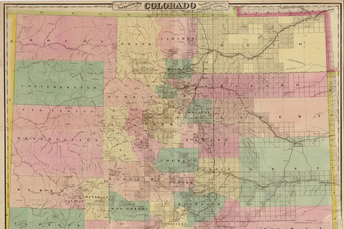
The first General Assembly of Colorado carved Gunnison County out of the western part of Lake County in an act approved March 9, 1877. On May 22 the county seat was placed, for the time being, at Gunnison, “then a mere cluster of rude cabins,” Hall says. You can see how big the county was from Hall’s numbers. He counts 10,600 square miles (27,450 km²) at the start and four counties since taken from it, Pitkin, Delta, Mesa and Montrose. Pitkin County is the one around Aspen, and Mesa County’s seat is Grand Junction, named for the meeting of the Gunnison River with the Grand.
A town company organized in 1879, with former Gov. John Evans, Henry C. Olney, Louden Mullen, Alonzo Hartman, Sylvester Richardson and others. West Gunnison was laid off by the Gunnison Town and Land Company in May 1880, and for a while the two sides were rivals. “In 1880 the two were united and incorporated,” Hall writes. In places, Hall calls the town “Gunnison City.”
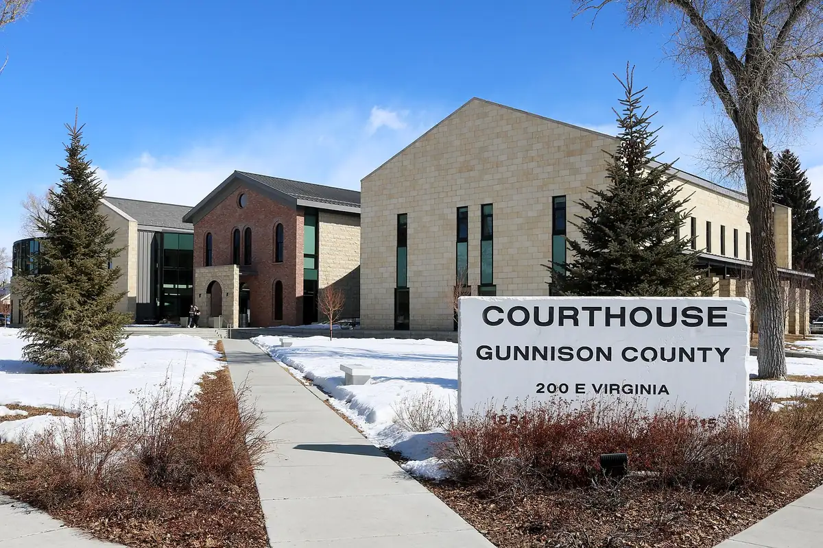
The courthouse in the photo below stands in the town Hall describes as the county’s capital.
The 1954 map, photorevised in 1970
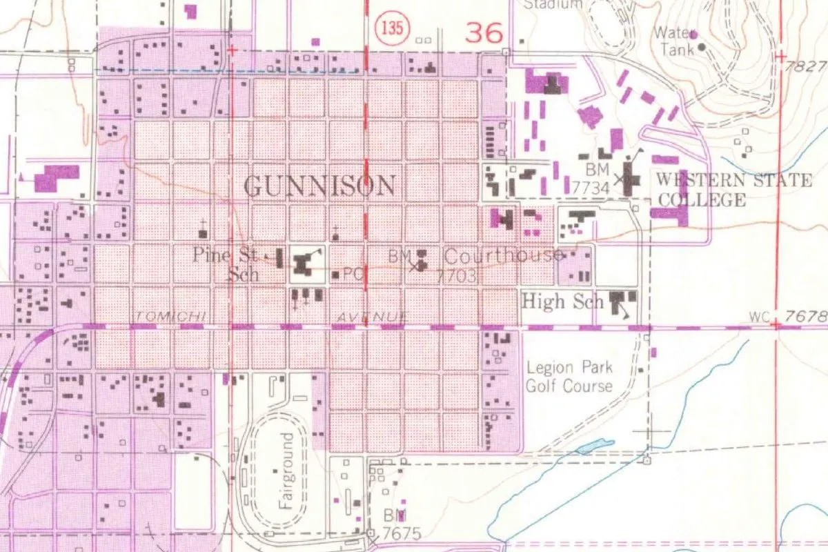
The map at the top of this page is a detail from the Geological Survey’s Gunnison quadrangle, made from aerial photographs taken in 1950 and field-checked in 1954. The copy shown is the version “photorevised” in 1970: the purple additions come from 1970 aerial photographs and, the margin warns, weren’t field checked. The copy shown was printed in 1973. You’ll see the courthouse marked near the middle of the grid, with Tomichi Avenue below it and the campus labeled Western State College to the east.
Quick answers
Who is Gunnison, Colorado, named after?
Capt. J. W. Gunnison of the U.S. Topographical Engineers. Hall (1895) says the county, its capital and its main river were all named for him, and Gannett (1905) adds a mountain and an island in the Great Salt Lake.
Did Captain Gunnison found the town?
No. He was killed near Sevier Lake in October 1853. Alonzo Hartman’s cabin dates from 1872, and Sylvester Richardson’s colony located the town in April 1874, Hall says.
What was Gunnison’s 1853 expedition for?
A railroad route. Hall says Jefferson Davis, then Secretary of War, ordered a survey for “the most practicable and economical route for a railroad from the Mississippi river to the Pacific ocean.”
When was Gunnison incorporated?
In 1880, when Gunnison and West Gunnison “were united and incorporated,” according to Hall.
Key dates
- 1853Congress authorizes the railroad surveys on March 3, and Gunnison's party leaves the Missouri River on June 17.
- 1853Capt. Gunnison is killed at his camp near Sevier Lake on October 26.
- 1872Alonzo Hartman arrives on December 25 to tend the Los Pinos agency's cattle and builds the first house.
- 1874Sylvester Richardson's colony arrives in April and locates the town, then disbands.
- 1877Gunnison County is created on March 9, and on May 22 its seat is placed at Gunnison.
- 1879A town company forms with John Evans, Louden Mullen, Alonzo Hartman, Sylvester Richardson and others.
- 1880Gunnison and West Gunnison are united and incorporated.
Things to do in Gunnison, Colorado
Gunnison Pioneer Museum
At the base of 'W' Mountain along Highway 50, the museum's 14-acre (5.7 ha) campus holds more than thirty buildings, among them the Paragon School House and Alonzo Hartman's Post Office.
Hartman Rocks Recreation Area
Over 14,000 acres (5,670 ha) of BLM land plus a 160-acre (65 ha) Base Area owned by the City of Gunnison and Gunnison County, with 45 miles (72 km) of singletrack trail and 45 miles (72 km) of roads. It's 3 miles (5 km) south of Gunnison on County Road 38.
Blue Mesa Reservoir
West of Gunnison in Curecanti National Recreation Area, Blue Mesa is the largest body of water in Colorado, the park service says, set among mesas and pinnacles in a high desert landscape.
Black Canyon of the Gunnison National Park
A canyon the Gunnison River sculpted over two million years, with some of the steepest cliffs and oldest rock in North America, by the park service's description. Its hiking trails range in difficulty, and some have steep drop-offs.
Getting there
Open Gunnison in Google Maps
Opens in a new tab. The pin is the center of Gunnison in the USGS place-name record.
The closest airports, Amtrak stations and intercity bus stops, measured in a straight line from the center of Gunnison.
Airports
- Gunnison-Crested Butte Regional (GUC) under 1 mi 1 km
- Aspen-Pitkin County/Sardy Field (ASE) 47 mi 75 km
Amtrak trains
- Glenwood Springs station (GSC) 72 mi 117 km
- Grand Junction station (GJT) 96 mi 154 km
Intercity buses
- Bustang Outrider Bustang · Gunnison under 1 mi 0.4 km
Distances are as the crow flies, not by road. We don't list schedules or fares because they change; check with the airline, Amtrak or the bus company before you go. Official data (FAA commercial service airports (2025), FAA airport locations, Amtrak stations and Intercity Bus Atlas) from the FAA and the U.S. Bureau of Transportation Statistics, checked Nov 17, 2026.
Sponsored
Staying in Gunnison?
Compare hotels in Gunnison, Colorado, on Expedia.
See hotels in GunnisonWe may earn a commission if you buy through this link. It never changes what we write. Read our affiliate disclosure
Historical Sources & References
- Frank Hall, History of the State of Colorado, vol. 4 (1895), p. 144. The county created on March 9, 1877, its size and the four counties taken from it, Capt. J. W. Gunnison and the names, the act of March 3, 1853, Davis’s survey order, the departure of June 17, his death on October 26 and Beckwith’s report. Checked against the page image.
- Hall (1895), p. 145. Richardson’s colony and his account of April 1874, Ouray in 1876, and the agency’s cattle camp near “Gunnison City.” Checked against the page image.
- Hall (1895), p. 146. Alonzo Hartman’s first house and his statement about December 25, 1872, and the cow camp a mile (1.6 km) below town. Checked against the page image.
- Hall (1895), p. 147. The county seat on May 22, “a mere cluster of rude cabins,” the town company of 1879, West Gunnison and the union of 1880. Checked against the page image.
- Henry Gannett, The Origin of Certain Place Names in the United States (1905), p. 146. The county, town, mountain, river and Great Salt Lake island named for Capt. J. W. Gunnison. Checked against the page image.
- Gunnison Pioneer Museum; Hartman Rocks Recreation Area; Curecanti reservoirs; Black Canyon of the Gunnison National Park. The details in the things-to-do list.
- GNIS feature ID 188995 (U.S. Geological Survey). Gunnison in the national gazetteer, in Gunnison County, with its coordinates.
- U.S. Geological Survey, Gunnison quadrangle (1954). The 1:24,000 quadrangle, photorevised in 1970 and printed in 1973, that the map at the top of this page was cropped from.
Spot something wrong, or know more? Tell us here. You can also email us or use our contact page. Corrections are noted here with their date, never made silently.