Lake Powell: History, Name and Visiting
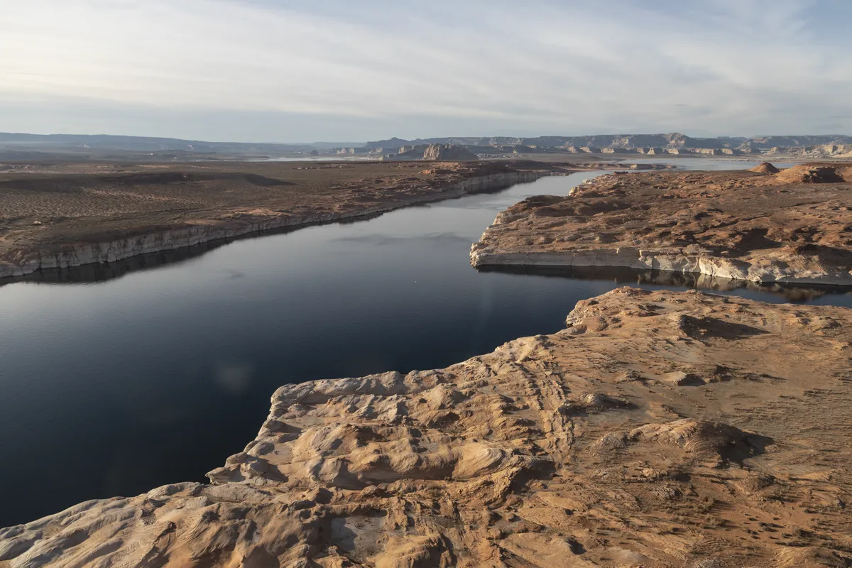
Lake Powell is named for John Wesley Powell, who floated through Glen Canyon in 1869 and named it, nearly a century before his canyon became a reservoir. The federal board that settles place names approved “Lake Powell” in 1959. In 2004 a group asked the same board to call it something plainer, and you’ll see below how that went.
Lake Powell History
Powell came through in the summer of 1869, at the head of what the Bureau of Reclamation calls “the first expedition down the Colorado River through the Grand Canyon.” The U.S. Geological Survey’s profile of him says he’d lost his right arm at Shiloh, came out of the Grand Canyon 99 days after setting off, and later ran the Survey itself, from 1881 to 1894.
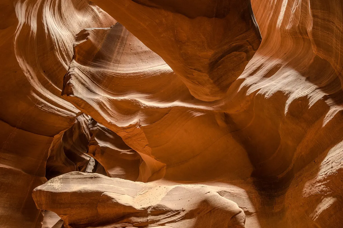
He named the canyon that’s now under the lake. In his 1875 report, under August 3, Powell describes side canyons, curving walls, “Oak Glens” with springs and cottonwoods, and monument-shaped buttes. Then he lists the candidates: “carved walls, royal arches, glens, alcove gulches, mounds, and monuments. From which of these features shall we select a name? We decide to call it Glen Canon.” Two days earlier, his party had camped in a hollow in the rock and named it Music Temple, after a song at night filled it with sound.
Then came the dam. Congress authorized the Colorado River Storage Project on April 11, 1956, to store water, control floods and make power, and the Board on Geographic Names says construction ran from 1956 to 1964, and the dam already had the name Glen Canyon Dam by 1959. That year the Board approved the name Lake Powell for the reservoir behind it. Reclamation says water began to back up behind the dam on March 13, 1963, and the lake reached full pool on June 22, 1980, at 3,700 feet (1,128 m) above sea level.
In 2004 a coalition based in Durango, Colorado, petitioned the Board to change the reservoir’s name to Glen Canyon Reservoir. It had two arguments, according to the Board’s minutes: a much smaller Lake Powell already existed in Grand County, Colorado, also named for Powell, and “Lake” was the wrong word for a body of water behind a dam. The Board received 163 letters and emails, 150 of them against the change. Arizona’s and Utah’s naming boards, the federal land agencies and a long list of elected officials all wanted the old name kept.
On October 20, 2004, the Domestic Names Committee voted 10 to 0 not to change it. It noted that “Lake” is very common for a man-made body of water (the docket had counted more than 30,000 of about 75,000 reservoirs in the federal database using the word), and that two Lake Powells almost 300 miles apart weren’t likely to be confused. It then reaffirmed Lake Powell as a 2004 decision, by 8 votes to 2. The two no votes didn’t favor the new name. They just thought a second decision wasn’t needed after the one from 1959.
Visiting Lake Powell
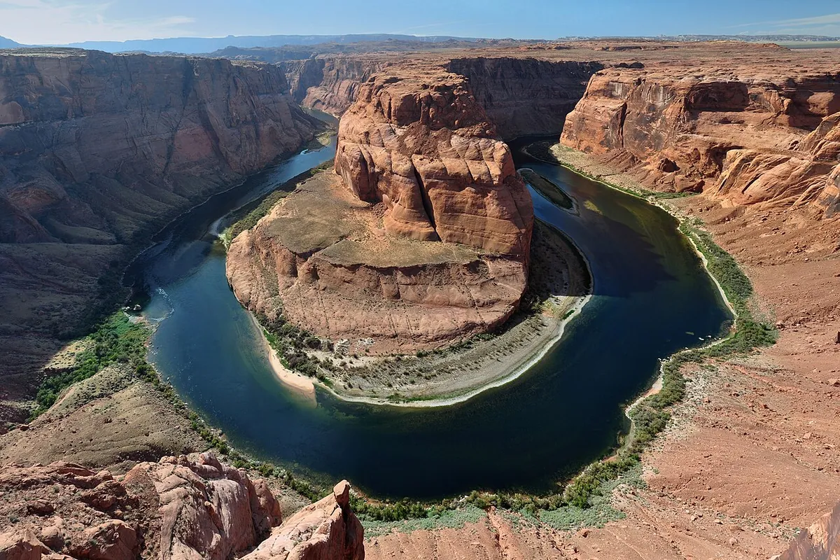
Reclamation says the lake is about 186 miles (299 km) long, with 1,960 miles (3,154 km) of shoreline when it’s full and space for more than 25 million acre-feet, enough to rank second among the nation’s reservoirs. The largest, Lake Mead, sits behind Hoover Dam, which went through a name dispute of its own: it was Boulder Dam in the Interior Department’s usage from 1933, and Hoover Dam again by act of Congress in 1947.
The lake rises from May to July with the snowmelt and drops the rest of the year, which leaves the pale ring you’ll see on the cliffs. In long droughts, Reclamation says, it can fall more than 200 feet (61 m) below full. The water stretches into more than 90 side canyons, and the National Park Service manages it as part of Glen Canyon National Recreation Area, which covers 1.25 million acres (506,000 ha). The Park Service’s fee page lists a weekly pass at $30 for a private vehicle, and boats with motors pay an extra fee. For a look at the dam itself, you can go to the Carl Hayden Visitor Center.
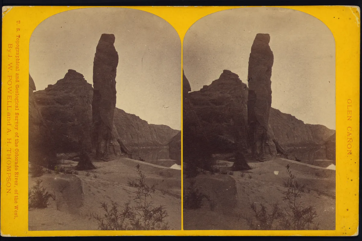
Powell’s river trip also turns up in the name story of the Grand Canyon. No one can say who first gave that canyon its adjective, but “grand” was already in print in 1857, a dozen years before Powell’s boats went through. The photo at the bottom of this page was made in 1872 by James Fennemore, a photographer for Powell’s survey, and it’s filed in the survey’s “Glen Cañon” series.
Quick answers
Who is Lake Powell named after?
John Wesley Powell. Reclamation says the lake honors the leader of the 1869 river trip that was the first to run the Colorado through the Grand Canyon. On that trip, Powell also named Glen Canyon, which the lake now fills.
Is Lake Powell a natural lake?
No. It’s a reservoir that formed behind Glen Canyon Dam, starting on March 13, 1963. The Board on Geographic Names noted in 2004 that “Lake” is a common word for man-made bodies of water.
Did anyone try to rename Lake Powell?
Yes. In 2004 a Colorado-based coalition proposed “Glen Canyon Reservoir.” The Board on Geographic Names voted it down 10 to 0 on October 20, 2004.
When did Lake Powell first fill up?
On June 22, 1980, 17 years after the water started rising, when the surface stood at 3,700 feet, according to the Bureau of Reclamation.
Key dates
- 1869August 3: John Wesley Powell's river party names Glen Canyon.
- 1872James Fennemore photographs Glen Canyon for Powell's survey.
- 1875Powell's report on the Colorado River explains why he called it Glen Canyon.
- 1956April 11: Congress authorizes the Colorado River Storage Project, which includes Glen Canyon Dam.
- 1959The U.S. Board on Geographic Names approves the name Lake Powell for the reservoir.
- 1963March 13: Lake Powell begins to fill behind Glen Canyon Dam.
- 1980June 22: the lake is full for the first time, at 3,700 feet above sea level.
- 2004October 20: the Board turns down a proposal to rename it Glen Canyon Reservoir.
Find it in Google Maps
Opens in a new tab. The pin is a point from the USGS place-name record, so it may not be the middle of the area.
Sponsored
Planning a visit?
Compare hotels in the area on Expedia.
See hotels nearbyWe may earn a commission if you buy through this link. It never changes what we write. Read our affiliate disclosure
Historical Sources & References
- U.S. Bureau of Reclamation, “Glen Canyon Dam”. “Named after Major John Wesley Powell,” who led the first expedition through the Grand Canyon in 1869; filling from March 13, 1963, to June 22, 1980, at 3,700 feet; 186 miles long, 1,960 miles of shoreline, 25 million acre-feet, second only to Lake Mead; more than 90 side canyons; the yearly rise and fall and drops of more than 200 feet; the Colorado River Storage Project of April 11, 1956.
- U.S. Board on Geographic Names, minutes of October 20, 2004, Docket 384. “Change Lake Powell (BGN 1959) to Glen Canyon Reservoir”: the Durango coalition, the smaller Lake Powell in Grand County, Colorado, the dam built 1956-1964 and named before 1959, Powell’s naming of Glen Canyon in 1869, the 163 letters, the 10-0 vote, the 30,000 reservoirs called “Lake,” and the 8-2 reaffirmation. Archived copy from the University of North Texas web archive.
- J. W. Powell, Exploration of the Colorado River of the West (1875). August 2 and 3, pp. 71-72: Music Temple, the Oak Glens, and “We decide to call it Glen Canon.”
- U.S. Geological Survey, “John Wesley Powell”. His right arm lost at Shiloh, the 1869 expedition and its 99 days, and his years as the Survey’s second director, 1881-1894.
- National Park Service, Glen Canyon National Recreation Area, “History & Culture”. More than 10,000 years of people in Glen Canyon, before the canyons “were filled by the waters of Lake Powell.” The recreation area’s 1.25 million acres and the Carl Hayden Visitor Center are on its Plan Your Visit page.
- National Park Service, Glen Canyon National Recreation Area, “Fees & Passes”. $30 per week per private vehicle and an extra fee for motorized boats.
- James Fennemore, “Island Monument” (1872), Library of Congress. The stereograph at the bottom of this page, from the series “U.S. topographical and geological survey of the valley of the Colorado River of the west, by J.W. Powell and A.H. Thompson,” Glen Cañon. The Library lists no known restrictions on publication.
- GNIS feature 1431462, Lake Powell (U.S. Geological Survey). Official name Lake Powell, a reservoir, by decision of the Board on Geographic Names.
Spot something wrong, or know more? Tell us here. You can also email us or use our contact page. Corrections are noted here with their date, never made silently.