What Does Ogunquit Mean? Not So Sure About "by the Sea"
The meaning is uncertain. The name first shows up for the river, in a land license of 1641. The town still uses the old translation, "Beautiful Place by the Sea," but its own 2024 plan says recent scholarship doubts it and suggests a Micmac word for lagoons at river mouths instead. Other readings exist too.
Ogunquit, Maine, takes its name from its river, but what the old Native American word means is unknown, and the town’s own plan doubts the popular answer. The town still uses the translation “Beautiful Place by the Sea,” but the record is a lot less tidy than that.
What does Ogunquit mean?
No one can say for certain. The town’s 2024 comprehensive plan says the name turns up in early documents “primarily in reference to the river,” and that when the Reverend John Wheelwright applied to build the first sawmill, he placed it on the “Agunquat” River. The oldest use this article could find is older still. In 1875 Edward E. Bourne printed, in his History of Wells and Kennebunk, a license that Thomas Gorges signed on September 27, 1641, letting a group of settlers take up land “between Ogunquitt River and Kennebunk.”
On the meaning, the plan is candid. It says the word “has long been thought to derive from the Natick tribe, meaning ‘Beautiful Place by the Sea,’ (which the Town still uses) but more recent scholarship casts doubt on that origin.” It offers a different candidate, a Micmac word, “pog-um-ik,” for the lagoons that form at the mouths of rivers, and then concludes that “the exact origin of the term is not known.”
Oconomowoc, Wisconsin, has the same problem: at least five versions of what its Potawatomi name means, and no clear winner. Punxsutawney, Pennsylvania, by contrast, settles on one meaning: “town of the sandflies.”
Ogunquit name origin: is it “Beautiful Place by the Sea”?
Probably not, at least not word for word. In June 2022 The Ogunquit Breeze, a newsletter from the Ogunquit Residents Alliance, went through the old guesses one by one. It starts with the local historian Esselyn Perkins, whose 1951 History of Ogunquit Village says the name had many meanings and spellings.
The newsletter’s list is long. A scholar it calls “Dr. Gagnong” compared the name to the Micmac POM-UM-IK, for lagoons made by dune beaches at the mouths of rivers, the same idea the town plan mentions. In a 1958 letter to Perkins, the historian and archaeologist Chester B. Price offered two phrases: NIGAN-KEK, “at the place of the portage,” for the spot where canoes were carried around the falls, and NEGONA KIK, which he read as “Beautiful Ancient Place.” Other sources give NEGUNTIQUIT, “old, abandoned fields”; OBUMKEGG, a sandbar where a stream meets bigger water, from the Penobscot historian Fannie Hardy Eckstrom; and O’DAWOMKAK, “a sand bank,” from a dictionary of 1884 by the Abenaki chief Joseph Laurent.
Then the newsletter checks the reference books. Henry Lorne Masta’s 1932 book on Abenaki place names doesn’t mention Ogunquit at all, it says, and an Abenaki-English dictionary published in 2019 doesn’t list “Beautiful Place by the Sea” among its New England place names. None of the candidates can be proved, so we treat the origin as disputed.
Ogunquit history: from Wells to its own town
For most of its life Ogunquit wasn’t a town. It was a village inside the town of Wells, in York County, Maine. Wells has given up land before: as the article on Kennebunkport explains, Wells lost its eastern side in 1820, when that part was incorporated as the town of Kennebunk.
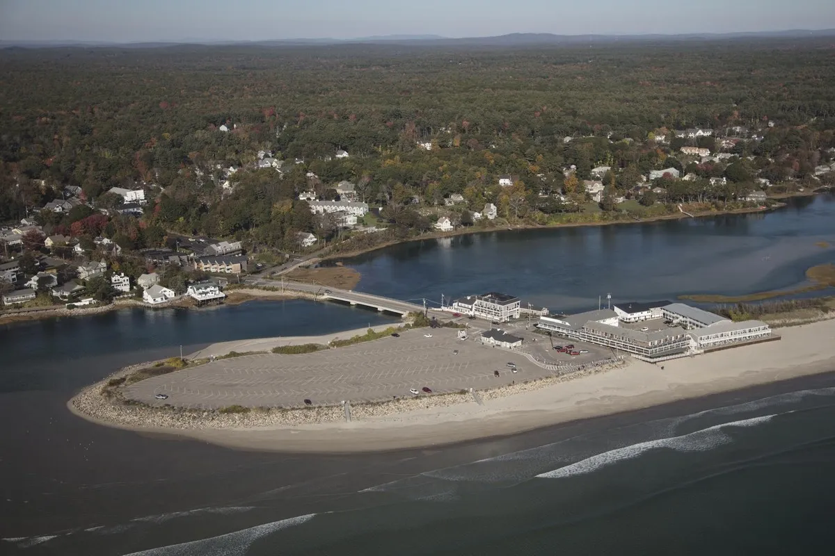
Artists came to Perkins Cove in the late 1800s, and summer visitors followed by train and trolley. The plan says the beach first became easy to reach in 1888, when Beach Street got a bridge over the river. In 1913 residents formed the Ogunquit Village Corporation, and when a developer from Wells bought up the shoreline in the early 1920s, they set up the Ogunquit Beach District under a state act of April 1, 1923, taxing themselves to take the beach back by eminent domain. It cost $43,500, the plan says, half of it in legal fees.
In 1925 Josiah Chase donated the first mile of the Marginal Way, and the path was paved in 1960. The Ogunquit Playhouse opened in a converted garage in 1933, and the Ogunquit Memorial Library, built in 1897, still stands in its fieldstone. The last step came in 1980. According to the preamble to the town charter, “On July 1, 1980, Ogunquit officially became a Town.”
Ogunquit on the 1893 maps
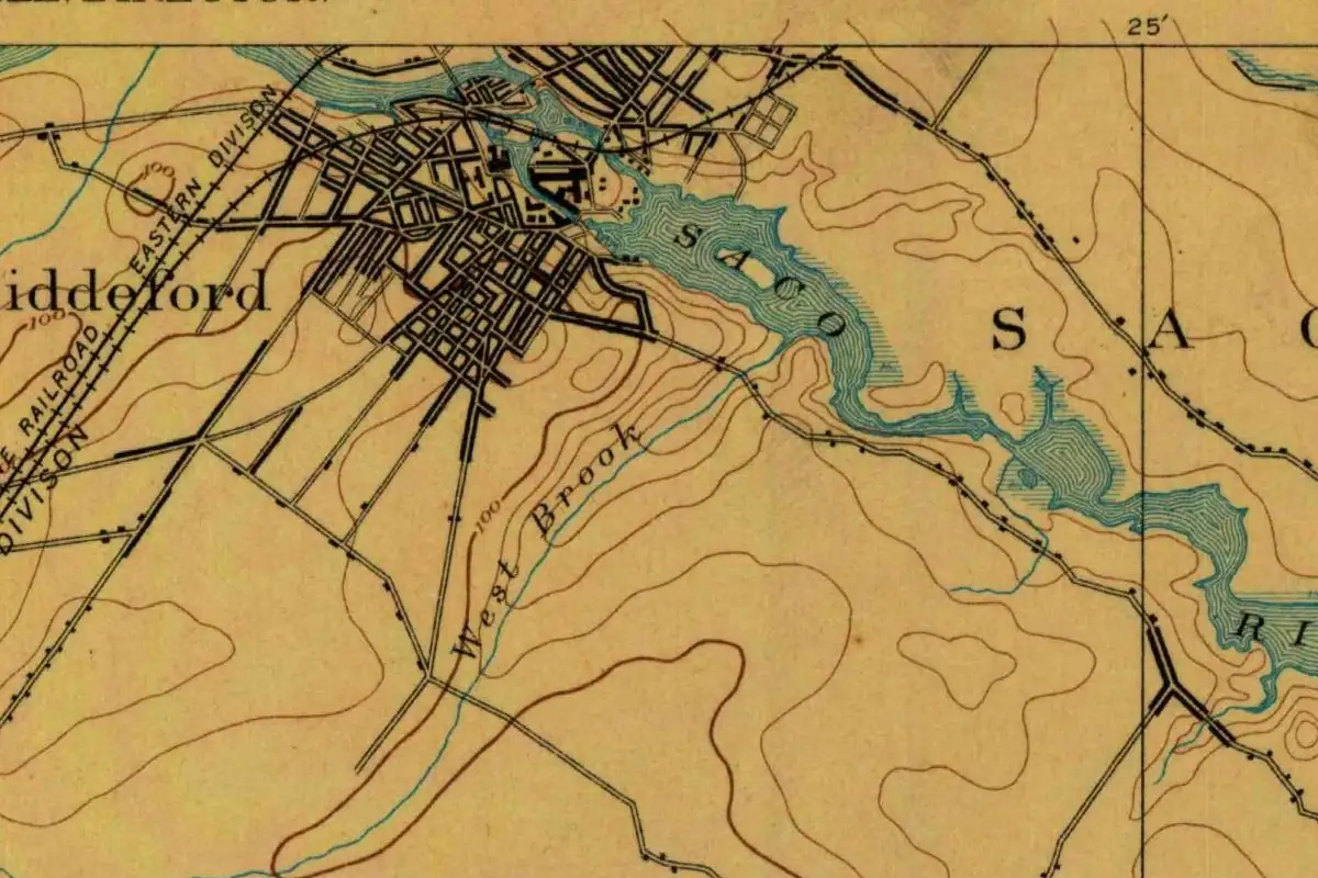
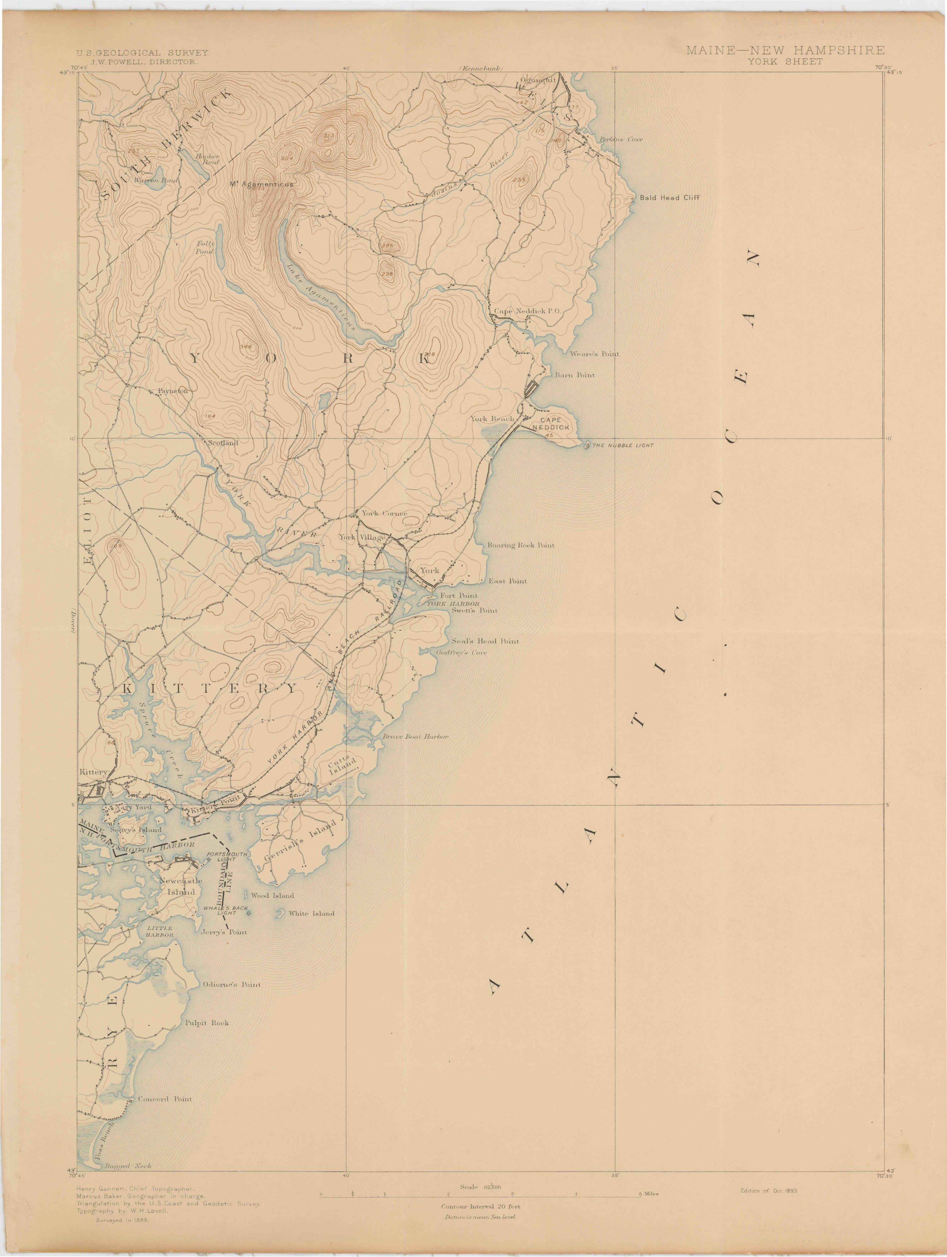
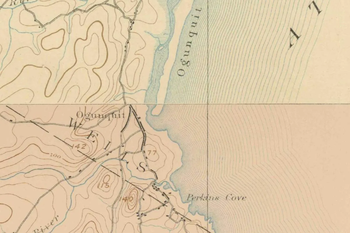
Ogunquit sits right where two Geological Survey sheets meet, so the map at the start of this article joins them. The lower part comes from the York sheet, surveyed in 1888 by W. H. Lovell and issued in October 1893, and the upper part from the Kennebunk sheet, surveyed in 1889 and issued in September 1893. Both are at 1:62,500.
On the York sheet the village is labeled Ogunquit, but the big letters across it spell WELLS, the town it still belonged to. Perkins Cove is marked on the shore. On the Kennebunk sheet the word Ogunquit runs along the beach, beside the winding river.
Quick answers
What language does the name Ogunquit, Maine, come from?
It’s a Native American name, but which language is disputed. The town plan mentions an old attribution to the Natick and a possible Micmac source; others have proposed Abenaki or Penobscot words.
When did Ogunquit, Maine, become a town?
On July 1, 1980, when it separated from Wells. It had been a village corporation since 1913.
How old is the name Ogunquit, Maine?
At least as old as 1641, when a land license printed by Edward Bourne named the Ogunquitt River.
Key dates
- 1641September 27: Thomas Gorges licenses settlers to take up land between the Ogunquitt River and the Kennebunk.
- 1888A bridge over the Ogunquit River at Beach Street opens the beach to visitors.
- 1897Work begins on the stone Ogunquit Memorial Library, which opens the following June.
- 1913The Ogunquit Village Corporation is formed inside the town of Wells.
- 1923April 1: the legislature approves the Ogunquit Beach District, which goes on to buy back the beach.
- 1925Josiah Chase gives the town a mile of what becomes the Marginal Way.
- 1933The Ogunquit Playhouse starts as a summer theater in a converted garage.
- 1951Esselyn Perkins's History of Ogunquit Village notes many meanings and spellings for the name.
- 1960The Marginal Way is paved.
- 1980July 1: Ogunquit becomes a town of its own, separate from Wells.
Things to do in Ogunquit, Maine
Marginal Way
A paved cliff walk of 1.25 miles (2 km) along the ocean, from near The Sparhawk on Shore Road to Perkins Cove. Its first mile was a 1925 gift from Josiah Chase.
Perkins Cove
A small harbor that is still a working fishing and artists' community, on a narrow neck of land between the Josias River and Oarweed Cove. Walkers cross the inlet to the harbor on the Perkins Cove Bridge.
Ogunquit Memorial Library
A fieldstone library in the Richardson Romanesque style, designed by Charles M. Burns and built in 1897 as Nannie Conarroe's memorial to her husband. It opened in 1898, was enlarged in 1914 and is on the National Register of Historic Places.
Ogunquit Playhouse
A nonprofit summer theater known for musicals. Its first season, in 1933, was in a converted garage; Walter and Maude Hartwig opened the current building in 1937.
Getting there
Open Ogunquit in Google Maps
Opens in a new tab. The pin is the center of Ogunquit in the USGS place-name record.
The closest airports, Amtrak stations and intercity bus stops, measured in a straight line from the center of Ogunquit.
Airports
- Portsmouth International at Pease (PSM) 17 mi 28 km
- Portland International Jetport (PWM) 31 mi 49 km
- General Edward Lawrence Logan International (BOS) Boston 65 mi 104 km
Amtrak trains
- Wells station (WEM) 6 mi 9 km
- Dover station (DOV) 16 mi 26 km
Intercity buses
- Greyhound Wells Sanford Road 6 mi 9 km
- FlixBus Portsmouth Bus Stop 15 mi 24 km
- CandJ Bus Lines Dover 17 mi 27 km
Distances are as the crow flies, not by road. We don't list schedules or fares because they change; check with the airline, Amtrak or the bus company before you go. Official data (FAA commercial service airports (2025), FAA airport locations, Amtrak stations and Intercity Bus Atlas) from the FAA and the U.S. Bureau of Transportation Statistics, checked Nov 21, 2026.
Sponsored
Staying in Ogunquit?
Compare hotels in Ogunquit, Maine, on Expedia.
See hotels in OgunquitWe may earn a commission if you buy through this link. It never changes what we write. Read our affiliate disclosure
Historical Sources & References
- Town of Ogunquit, Comprehensive Plan (2024), Chapter 1. The “Agunquat” River, “Beautiful Place by the Sea” and the doubts about it, “pog-um-ik,” the 1888 bridge, 1913, the Beach District of 1923, the Marginal Way, the Playhouse and 1980.
- The Ogunquit Breeze, June 2022. Perkins in 1951, POM-UM-IK, Chester B. Price, NEGUNTIQUIT, Eckstrom, Laurent, Masta and the 2019 Abenaki dictionary.
- Edward E. Bourne, History of Wells and Kennebunk (1875). The Gorges license of September 27, 1641, naming the Ogunquitt River.
- Town of Ogunquit Charter, Preamble. The Village Corporation of 1913 and the town of July 1, 1980.
- Ogunquit Memorial Library, “History of the Library”. The building of 1897-98 and its architect.
- U.S. Geological Survey, GNIS feature 582646. The Town of Ogunquit in York County.
- York sheet, edition of October 1893 and Kennebunk sheet, edition of September 1893. The two sheets joined for the map.
Sponsored
Put this 1893 map on your wall
The Geological Survey's York sheet of 1893, with Ogunquit at its top edge and the coast running south past Cape Neddick to York and Kittery, is in the public domain. Download the full-size scan for free, then have it printed on canvas with CanvasOnTheCheap.
Print a map on canvasDownload the full-size mapWe may earn a commission if you buy through this link. It never changes what we write. Read our affiliate disclosure
Spot something wrong, or know more? Tell us here. You can also email us or use our contact page. Corrections are noted here with their date, never made silently.