Cape Girardeau, Missouri: A Cape Named for Which Girardot?
The city is named for a rocky cape on the Mississippi that Lieutenant Ross's map of 1765 already called Cape Girardot, historian Louis Houck wrote in 1908. Most accounts credit a French ensign named Girardot from Kaskaskia, but Houck said how the place got the name 'cannot now be definitely known.' Merriam-Webster gives juh-RAR-doh, or juh-RAH-duh.
Cape Girardeau, Missouri, takes its name from a bend of the Mississippi that a 1765 map called Cape Girardot, when nobody had settled there yet. The cape was named for a Frenchman called Girardot. Which Girardot, and how his name got attached to a rock in the river, is a question the old historians admitted they couldn’t answer.
A name on the map before a town
Louis Houck, whose three-volume History of Missouri came out in 1908, says this stretch of river “was designated on the old maps as ‘Cap Girardot,’ and so known to the voyaguers passing up and down the river.” Then he points to the date. “On the map of Lieutenant Ross, published in 1765, we find the bend of the river above the site of the present city named ‘Cape Girardot,’ and yet no settlement existed at that time in this region.”
That’s only a year after Pierre Laclède named St. Louis, upriver, in 1764. So the name came first. The town that took it didn’t start until Louis Lorimier set up his trading post in 1793, Houck writes. The City of Cape Girardeau dates its founding to January 4 of that year.
The spelling wandered. Houck found “Girardot,” “Girardeau” and “Girardo” on old maps, and the Federal Writers’ Project guide to Missouri, published in 1941, says maps as early as 1765 call the point “Cape Girardot” or “Girardeau.”
Which Girardot?
Here’s where you have to be careful, because the sources aren’t sure. Houck put it plainly: “How this locality received the name of ‘Cape Girardot’ cannot now be definitely known.”
He passed along a guess. “It is conjectured by Mason that the name is derived from that of an ensign of the French troops named ‘Girardot,’ who as early as 1704 was stationed at Kaskaskia,” the old French town across the river in Illinois. The idea, Houck says, is that this Girardot moved to the west bank and traded with the Indians on the promontory, and that river travelers named the place for him. “No authentic information is now available as to this point,” he added.
Houck’s footnotes name two candidates from old church records. One is “Sieur Jean B. Girardot,” listed in 1721 as “an ensign of the ‘troupes de Marine.’” The other is Pierre de Girardeau, an infantry ensign and the son of Jean Pierre de Girardeau, an officer of the Marine troops.
Later accounts each picked one. Henry Gannett’s 1905 The Origin of Certain Place Names in the United States says that the county and city were “named for Sieur Girardot, of Kaskaskia.” The National Park Service says the camp of Lewis and Clark here stood near “a high limestone promontory” where “Jean Baptiste de Girardot established a trading post in 1733.” The WPA guide says the ensign “is thought to have settled on ‘the Cape’” about 1720. The city’s own history names “Ensign Jean Pierre Girardeau” in the early 1760s and says, “It is believed that Cape Girardeau took its name from this site.” The Missouri Secretary of State calls a French officer named Girardot the “generally accepted” source and then repeats Houck’s doubt.
All of them point to a Frenchman named Girardot, or Girardeau. They don’t agree on his first name or his dates, which is why this page counts the origin as disputed.
Lorimont, almost
The town nearly got a different name. In 1797, Houck says, the settlement around Lorimier’s house “was also referred to as ‘Lorimont’ by some of the petitioners for land, but this name did not supersede the traditional name.” The city’s history says Lorimont was considered too. The same history says the town was platted in 1806, incorporated in 1808 and became a city in 1843.
The cape itself
The rock that carried the name is mostly gone. The Park Service says “much of it was blasted away for the construction of railroad tracks along the river around 1900,” and the city keeps what’s left as Cape Rock Park. The city calls Cape Girardeau one of the few cities named after an inland cape.
Lewis and Clark arrived on November 23, 1803, the Park Service says, and Meriwether Lewis met Lorimier. The party had come down the Ohio in 1803, past the site of Paducah, Kentucky, and turned up the Mississippi where Cairo, Illinois, stands today.
How to say it
Merriam-Webster gives two pronunciations, \jə-ˈrär-(ˌ)dō\ and \jə-ˈrä-də. Either way, you’d put the stress on the middle: juh-RAR-doh or juh-RAH-duh.
The 1922 map
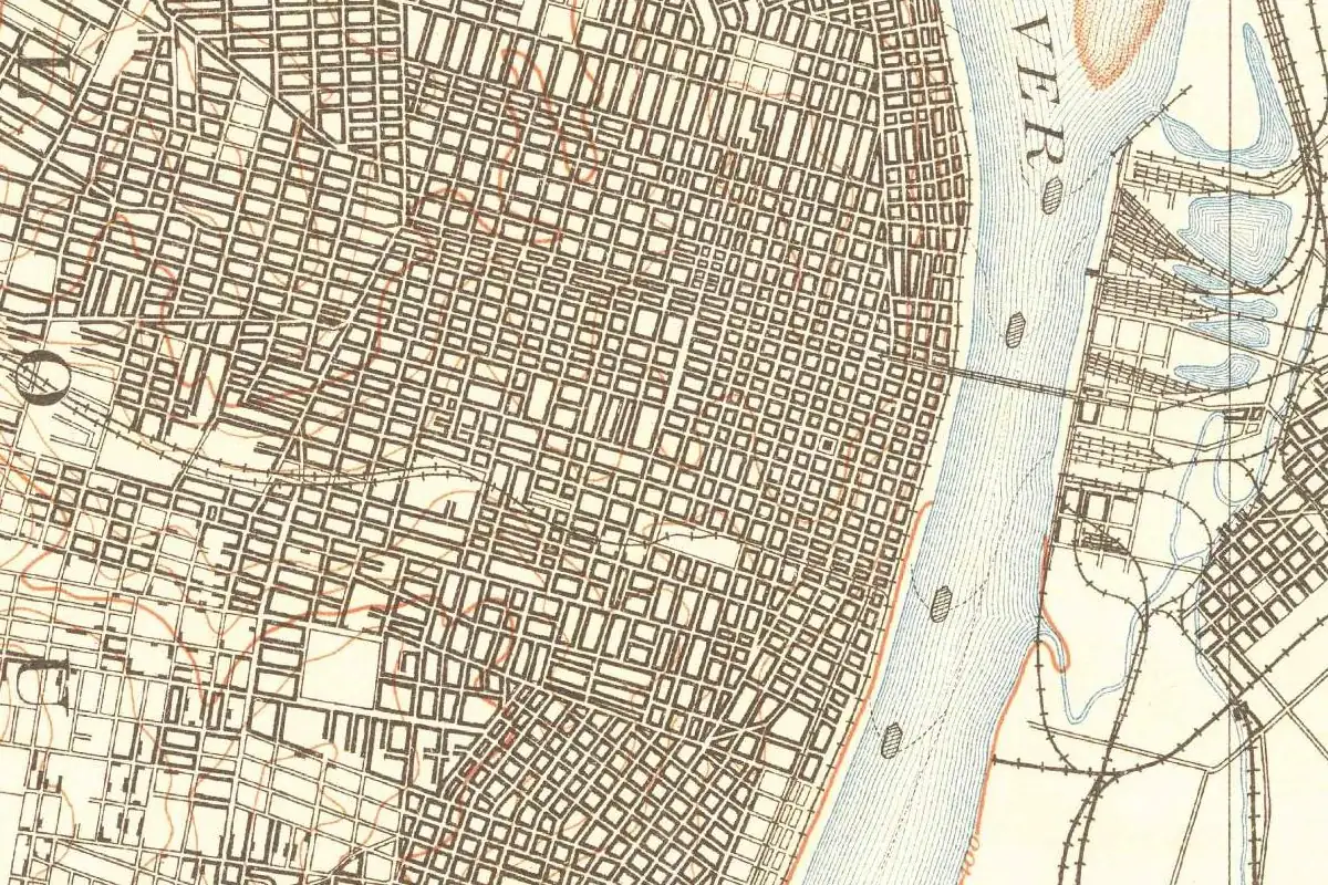
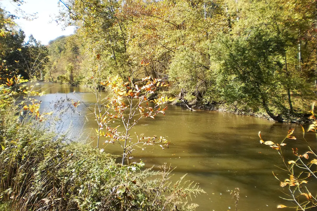
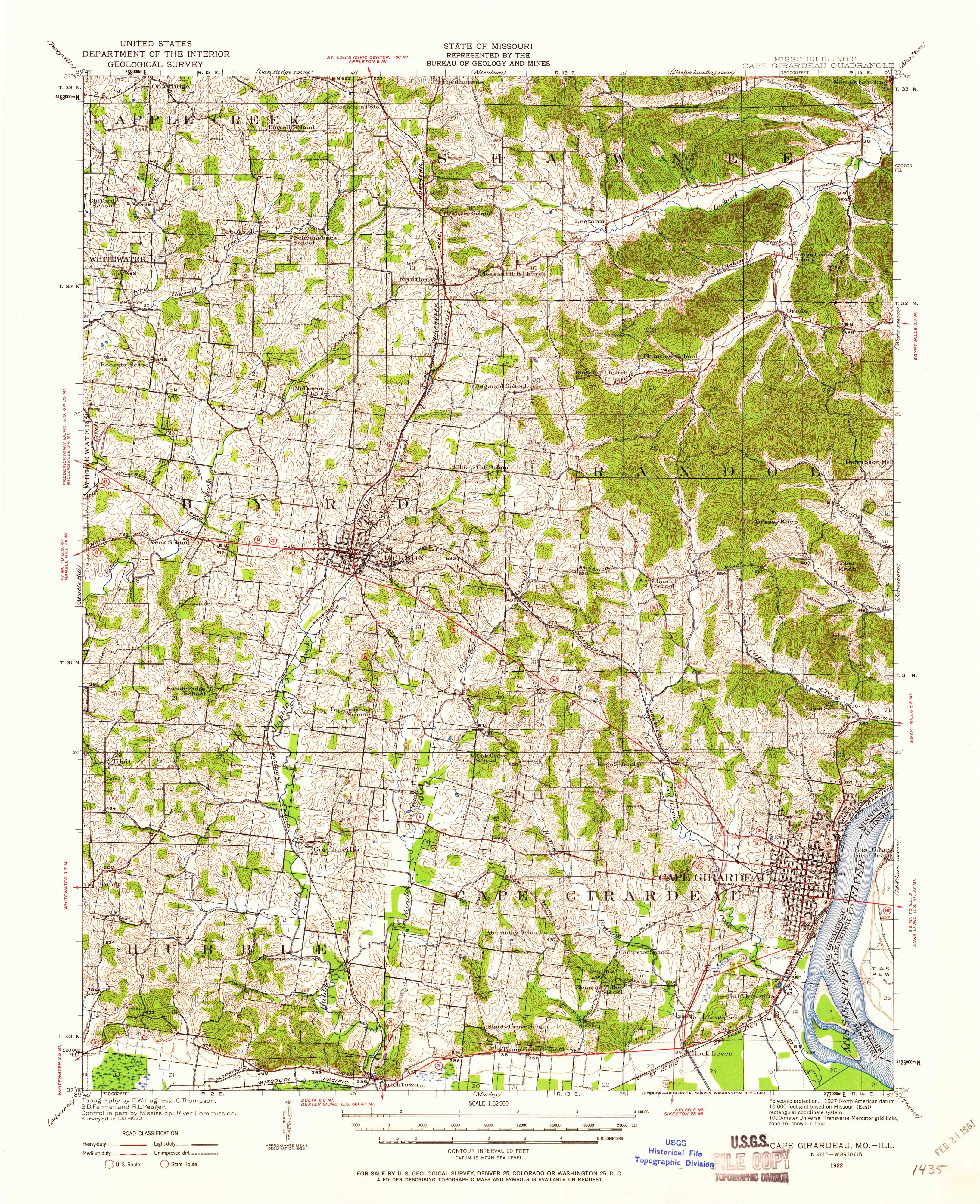
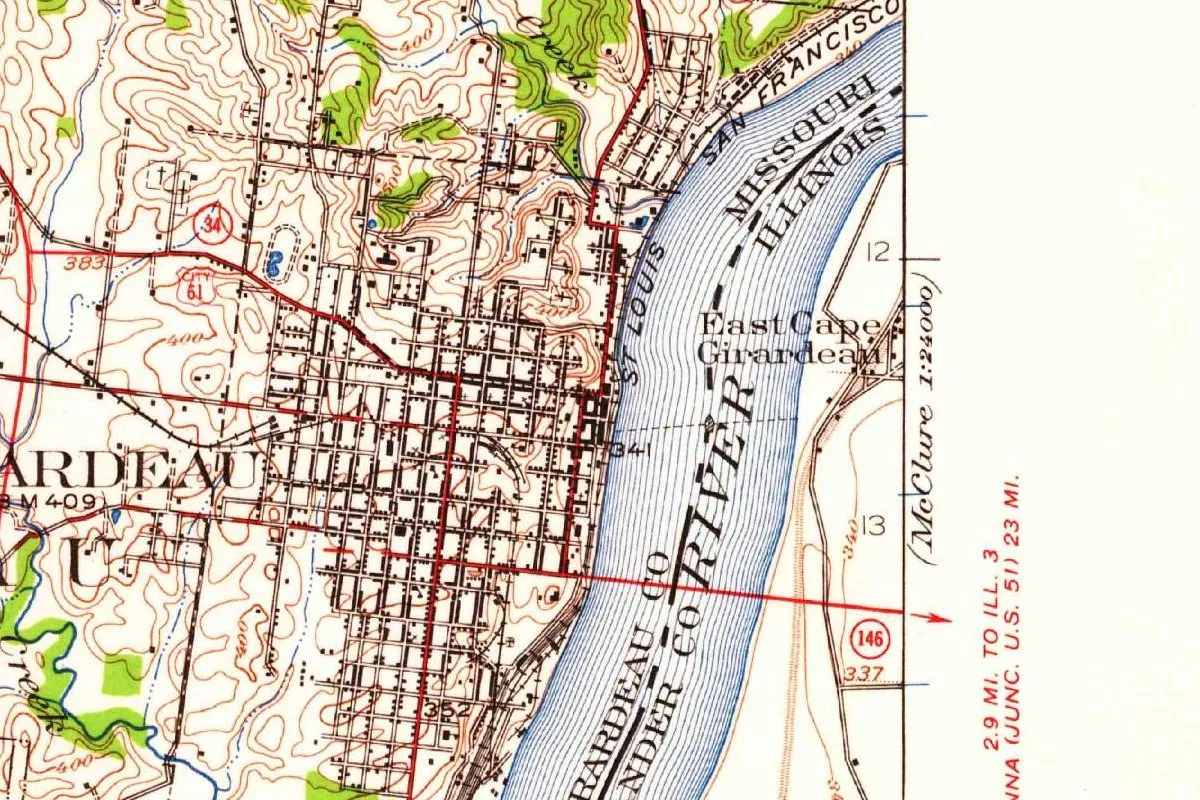
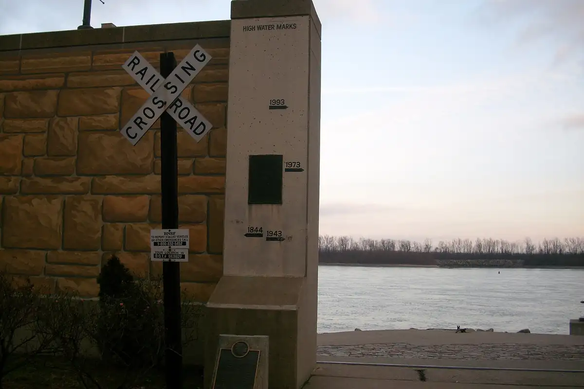
The map at the top of this page comes from the Geological Survey’s Cape Girardeau sheet, surveyed in 1921 and 1922. This copy was printed in 1961, with the highways of that time. The city fills a tight grid on the west bank, with East Cape Girardeau across the river and the state line drawn down the middle of the water. The photo below shows the river from the floodwall downtown.
Quick answers
Who is Cape Girardeau named after?
A Frenchman named Girardot, for whom a rocky cape on the Mississippi was named before 1765. Houck wrote in 1908 that how the place got the name “cannot now be definitely known,” and later accounts give him different first names and dates.
How do you pronounce Cape Girardeau?
Merriam-Webster gives \jə-ˈrär-(ˌ)dō, or juh-RAR-doh, and also \jə-ˈrä-də, or juh-RAH-duh.
Is there really a cape at Cape Girardeau?
There was a rocky promontory. The National Park Service says much of it was blasted away for railroad tracks around 1900, and what’s left is Cape Rock Park.
Who founded Cape Girardeau?
Louis Lorimier, who set up his trading post in 1793, Houck writes. The city dates its founding to January 4, 1793.
Key dates
- 1704A French ensign named Girardot is stationed at Kaskaskia by this year, according to the conjecture Houck reports.
- 1733The National Park Service dates Girardot's trading post on the promontory to this year.
- 1765Lieutenant Ross's map labels the bend of the river Cape Girardot, though no settlement exists there.
- 1793Louis Lorimier sets up his trading post; the city dates its founding to January 4.
- 1797Some petitioners call the settlement Lorimont, a name that doesn't replace the old one.
- 1803Lewis and Clark reach Cape Girardeau on November 23, and Meriwether Lewis meets Lorimier.
- 1812Cape Girardeau County is organized on October 1.
- 1843Cape Girardeau becomes a city, after its incorporation as a town in 1808.
Things to do in Cape Girardeau, Missouri
Red House Interpretive Center
A Certified Lewis and Clark Trail Site off Main Street that honors Louis Lorimier, the town's founder, and the visit of Lewis and Clark in November 1803. It has an exhibit on early settlers and a rendering of Lorimier's trading post.
Cape Rock Park
What's left of the namesake promontory, kept by the city as a park. The Park Service says much of the rock was blasted away for railroad tracks along the river around 1900.
Trail of Tears State Park
Missouri State Parks says nine of the 13 Cherokee detachments being forced west crossed the Mississippi here in the winters of 1838 and 1839, and the visitor center has exhibits on that crossing.
Crisp Museum
Southeast Missouri State University's museum, on its River Campus, with history and fine art galleries and a video on the region's people and land in the Crossroads Theatre.
Cape Girardeau Conservation Nature Center
A state nature center with hands-on exhibits, freshwater aquariums and the White Oak Trace, two miles (3 km) of trails through oak-hickory forest, past sinkholes and a small man-made swamp.
Getting there
Open Cape Girardeau in Google Maps
Opens in a new tab. The pin is the center of Cape Girardeau in the USGS place-name record.
The closest airports, Amtrak stations and intercity bus stops, measured in a straight line from the center of Cape Girardeau.
Airports
- Cape Girardeau Regional (CGI) 6 mi 10 km
- Veterans Airport of Southern Illinois (MWA) Marion 42 mi 67 km
- St Louis Lambert International (STL) St. Louis 110 mi 177 km
Amtrak trains
- Carbondale station (CDL) 33 mi 54 km
- Du Quoin station (DQN) 51 mi 82 km
Intercity buses
- Greyhound Cape Girardeau Leming Lane 2 mi 3 km
- Executive Transportation Amtrak Connecting Service · Carbondale 33 mi 54 km
- FlixBus Carbondale Train Station 33 mi 54 km
Distances are as the crow flies, not by road. We don't list schedules or fares because they change; check with the airline, Amtrak or the bus company before you go. Official data (FAA commercial service airports (2025), FAA airport locations, Amtrak stations and Intercity Bus Atlas) from the FAA and the U.S. Bureau of Transportation Statistics, checked Nov 17, 2026.
Sponsored
Staying in Cape Girardeau?
Compare hotels in Cape Girardeau, Missouri, on Expedia.
See hotels in Cape GirardeauWe may earn a commission if you buy through this link. It never changes what we write. Read our affiliate disclosure
Historical Sources & References
- Louis Houck, A History of Missouri, vol. 2 (1908), pp. 168-169. “Cap Girardot” on the old maps, Lieutenant Ross’s map of 1765, “cannot now be definitely known,” Mason’s conjecture, the Fort de Chartres records, the spellings, Lorimont and Lorimier’s post of 1793. Checked against the page images.
- Federal Writers’ Project, Missouri: A Guide to the “Show Me” State (1941), p. 200. The ensign “thought to have settled on ‘the Cape’” about 1720, and the maps of 1765. Checked against the page image.
- Henry Gannett, The Origin of Certain Place Names in the United States (1905), p. 68. “Named for Sieur Girardot, of Kaskaskia.” Checked against the page image.
- Missouri Secretary of State, “Origins of Missouri Counties”. The county, organized October 1, 1812, and the “generally accepted” Girardot.
- City of Cape Girardeau, “History”. Jean Pierre Girardeau, the founding date, Lorimont, the inland cape, and the town and city dates.
- National Park Service, “Old Cape Girardeau”. Lewis and Clark on November 23, 1803, the trading post of 1733 and the blasted promontory.
- Merriam-Webster, “Cape Girardeau”. The pronunciation.
- Red House Interpretive Center; Trail of Tears State Park; Crisp Museum; Cape Girardeau Conservation Nature Center. The details in the things-to-do list.
- GNIS feature 731549 (U.S. Geological Survey). Cape Girardeau’s entry in the federal names database, in Cape Girardeau County, with its coordinates.
- U.S. Geological Survey, Cape Girardeau sheet (1922). The 1:62,500 map that the image at the top of this page was cropped from.
Sponsored
Put this 1922 map on your wall
The 1922 USGS Cape Girardeau sheet (Missouri and Illinois), in a 1961 printing, is in the public domain. Download the full-size scan for free, then have it printed on canvas with CanvasOnTheCheap.
Print a map on canvasDownload the full-size mapWe may earn a commission if you buy through this link. It never changes what we write. Read our affiliate disclosure
Spot something wrong, or know more? Tell us here. You can also email us or use our contact page. Corrections are noted here with their date, never made silently.