Why Is It Called Hendersonville? A Chief Justice's Name
Hendersonville is named for Leonard Henderson, chief justice of the North Carolina Supreme Court, who died in 1833. Henderson County, created in 1838, carried his name first, and an act ratified on January 7, 1847, set up the Town of Hendersonville as its seat. Judge Mitchell King gave the land, but the name isn't his.
Hendersonville, North Carolina, is named for Chief Justice Leonard Henderson, not for Judge Mitchell King, the man who gave the land for the county seat. Two judges stand at the start of the town’s story, and only one of them supplied its name.
Why is it called Hendersonville, North Carolina?
The town is named for its county, and the county for a judge. A proclamation the city issued for its 175th anniversary lays out the order. Henderson County was carved out of the southern end of Buncombe County in 1838. Then, on January 7, 1847, the General Assembly passed an act setting up the Town of Hendersonville as the seat of the county, “named in honor of Judge Leonard Henderson, Chief Justice of the Supreme Court of North Carolina.”
The city has posted a scan of that law, a page from the session laws North Carolina’s legislature passed that winter. It’s titled “An Act to incorporate the town of Hendersonville, in the county of Henderson,” and it sets the town limits at half a mile in every direction from the courthouse, without crossing Mud Creek. It gives no reason for the name. For that you need the proclamation.
Henry Gannett said the same in 1905. The entry in his federal bulletin of place-name origins runs a single line: “named for Chief Justice Leonard Henderson.”
Why honor Henderson at all? A 1996 history of the town, written by Mattson, Alexander and Associates and posted by the Hendersonville Historic Preservation Commission, says the General Assembly wanted a way to honor the judge, who had died in 1833. Backers of the new county took his name for it “in exchange for eastern support of the new county.”
A state highway marker, G-99, sums him up as “Jurist and educator.” The state’s write-up for the marker says he was born in 1772 on Nutbush Creek, then part of Granville County, and learned law from his uncle, Judge John Williams. He sat as a superior court judge from 1808 until he resigned in 1816. When the state created a three-member Supreme Court, he served on it, and he became chief justice in 1829.
He also taught. For thirty years he ran a law school out of his law office at Williamsborough, and from 1817 to 1828 he sat on the board of trustees of the University of North Carolina. He’s buried at Montpelier, the Williamsborough home of his uncle. The same write-up notes that two places carry his name: Henderson County, and Henderson, a town incorporated in 1841.
Allentown, Pennsylvania, honors William Allen, who owned the ground the town went up on in 1762 and also served as the colony’s chief justice, so the judge and the landowner were one man. Paterson, New Jersey, honors William Paterson, a governor who later sat on the U.S. Supreme Court. In Hendersonville, the name and the ground came from two different men.
Hendersonville, NC history: Mitchell King’s land and a wide Main Street
The ground came from Mitchell King. The city’s proclamation says that in 1841 “Judge Mitchell King of Charleston, South Carolina” donated 56 acres (23 ha) from his summer estate as a site for the county seat. The 1996 history gives other numbers: the seat was fixed two years after the county’s creation, on 79 acres (32 ha) near Mud Creek, a tract given “primarily” by King, whom it calls the area’s largest landowner and places in both Flat Rock and Charleston. Neither source gives him the name.
The surveyor James Justice laid out 40 lots, the 1996 history says, with a square at the center of Main Street saved for the courthouse, which went into service in 1844. King had trees planted along Main Street, and he wanted it 100 feet (30 m) wide so that “a carriage and four horses could turn around without backing.” The city’s proclamation still calls it “a remarkable one hundred feet in width.” In March 1988 the street went on the National Register of Historic Places.
The railroad arrived on July 4, 1879, and the town threw a celebration, according to the 1996 history. The Advisory Council on Historic Preservation puts Hendersonville 22 miles (35 km) south of Asheville, the seat of the Buncombe County it was carved from. In 1913, the city says, the Town of Hendersonville became the City of Hendersonville.
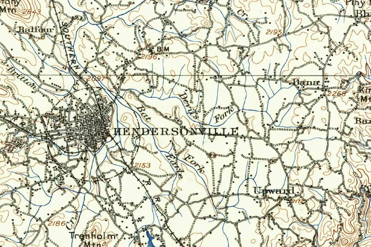
Hendersonville on the 1907 map
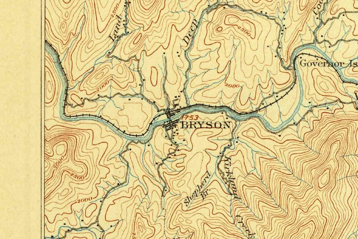
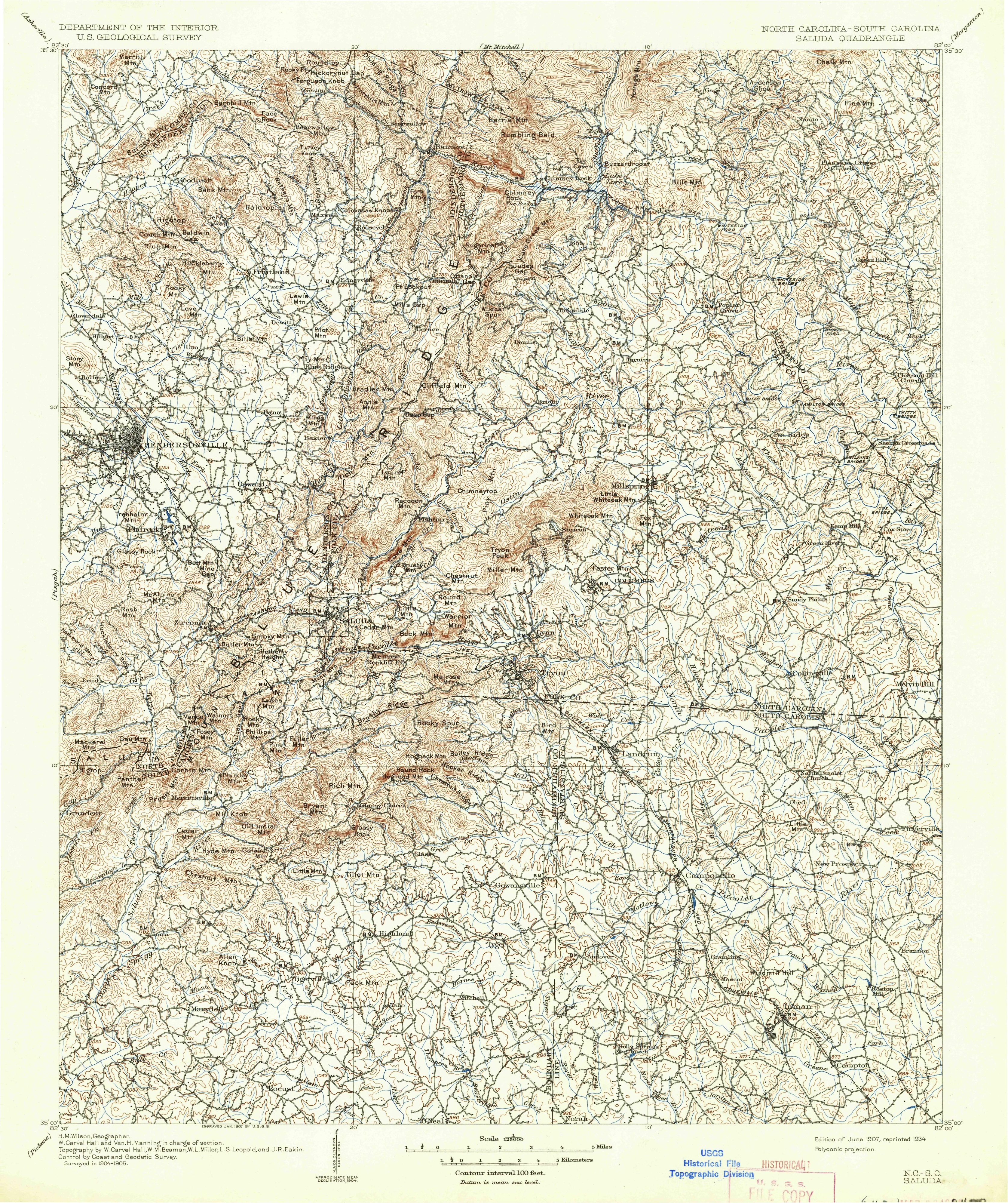
The map at the top was cropped from the Geological Survey’s Saluda quadrangle, a North Carolina-South Carolina sheet at 1:125,000. Its margin credits H. M. Wilson as geographer, with W. Carvel Hall and Van H. Manning in charge of the section, and topography by Hall, W. M. Beaman, W. L. Miller, L. S. Leopold and J. R. Eakin. It reads “Surveyed in 1904-1905” and “Engraved Jan. 1907.” What you see is a later printing; the bottom margin reads “Edition of June 1907, reprinted 1934.”
Hendersonville sits near the sheet’s western edge, and the margin names Asheville as the sheet that adjoins it at the northwest corner. In the crop, the name is printed in big letters east of a dense street grid, with the Southern Railroad running through town. Britton Creek and Devils Fork wind across the farmland, and Balfour, Dana and Upward are scattered around it.
Quick answers
Who is Hendersonville, North Carolina, named after?
Leonard Henderson, chief justice of the North Carolina Supreme Court, who died in 1833. The town is named for Henderson County, which was named for him.
Was Hendersonville, North Carolina, named for Mitchell King?
No. King, a judge from Charleston, gave the land for the county seat, but the city and the 1996 history both give the name to Leonard Henderson.
When was Hendersonville, North Carolina, founded?
The county was formed in 1838, King’s land gift came in 1841 by the city’s count, and the act setting up the town was ratified on January 7, 1847.
Key dates
- 1772Leonard Henderson is born on Nutbush Creek, then part of Granville County.
- 1829Henderson becomes chief justice of the North Carolina Supreme Court.
- 1833Henderson dies and is buried at Montpelier, near Williamsborough.
- 1838The General Assembly carves Henderson County out of the southern end of Buncombe County.
- 1841Judge Mitchell King of Charleston donates land for the county seat, 56 acres by the city's count.
- 1844The first courthouse goes into service on the square set aside on Main Street.
- 1847January 7: the act that sets up the Town of Hendersonville is ratified.
- 1879July 4: the railroad reaches Hendersonville, and the town turns out to celebrate.
- 1907The Saluda map sheet, surveyed in 1904-1905, is published with Hendersonville near its western edge.
- 1913The Town of Hendersonville becomes the City of Hendersonville.
- 1988In March, Main Street joins the National Register of Historic Places.
Things to do in Hendersonville, North Carolina
Historic Courthouse and Henderson County Heritage Museum
The restored courthouse at First and Main, where the city suggests history-minded visitors begin, is home to the Henderson County Heritage Museum.
Main Street Historic District
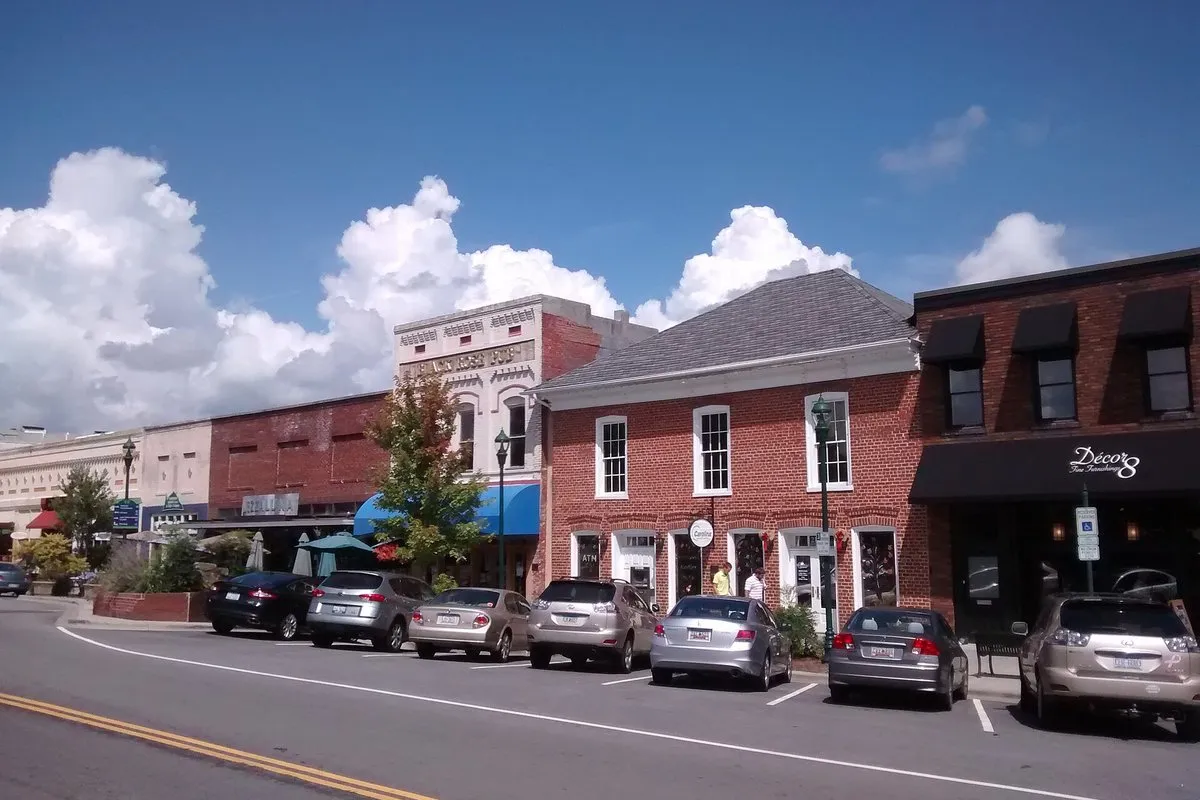
Walk north from the courthouse toward 7th Avenue past old buildings now filled with shops; brochures for a self-guided tour are at 201 South Main Street, the city's Visitor's Center.
Historic Hendersonville Depot and Apple Valley Model Railroad Club
The 1902 railroad depot holds a 22-by-100-foot (7 by 30 m) HO-scale model railroad set in Western North Carolina, along with railroad artifacts and a Southern Railway caboose that visitors can step inside.
Historic Johnson Farm
A heritage education museum that belongs to the county schools, with an 1876 farmhouse, nature trails, animals and ten old buildings spread over 15 acres (6 ha) of woods, fields and streams. It's on the National Register of Historic Places.
Carl Sandburg Home National Historic Site
Connemara, the 245-acre (99 ha) estate near Flat Rock that the poet Carl Sandburg and his wife Paula bought in 1945, partly for her dairy goats. Christopher Memminger built its main house in 1838.
Getting there
Open Hendersonville in Google Maps
Opens in a new tab. The pin is the center of Hendersonville in the USGS place-name record.
The closest airports, Amtrak stations and intercity bus stops, measured in a straight line from the center of Hendersonville.
Airports
- Asheville Regional (AVL) 9 mi 15 km
- Greenville Spartanburg International (GSP) Greer 32 mi 52 km
- Charlotte/Douglas International (CLT) 85 mi 138 km
Amtrak trains
- Greenville station (GRV) 32 mi 51 km
- Spartanburg station (SPB) 39 mi 63 km
Intercity buses
- Sunway Charters Asheville 20 mi 32 km
- Greyhound Asheville Asheland Ave 20 mi 32 km
- FlixBus Spartanburg 34 mi 56 km
Distances are as the crow flies, not by road. We don't list schedules or fares because they change; check with the airline, Amtrak or the bus company before you go. Official data (FAA commercial service airports (2025), FAA airport locations, Amtrak stations and Intercity Bus Atlas) from the FAA and the U.S. Bureau of Transportation Statistics, checked Nov 21, 2026.
Sponsored
Staying in Hendersonville?
Compare hotels in Hendersonville, North Carolina, on Expedia.
See hotels in HendersonvilleWe may earn a commission if you buy through this link. It never changes what we write. Read our affiliate disclosure
Historical Sources & References
- City of Hendersonville, “175th Anniversary”. The proclamation: the county in 1838, King’s gift of 56 acres in 1841, the act of January 7, 1847, and the name “in honor of Judge Leonard Henderson”; the change to City in 1913; Main Street’s width and its listing in March 1988.
- An Act to incorporate the town of Hendersonville (1847). The law itself, ratified January 7, 1847, with the half-mile limits. Checked against the page images.
- Mattson, Alexander and Associates, “History and Architecture of Hendersonville” (1996). The 79 acres near Mud Creek, King as main donor, the deal behind the name, the plat of 40 lots, the courthouse of 1844, the 100-foot Main Street and the railroad in 1879.
- NC Department of Natural and Cultural Resources, marker G-99. Henderson’s life, his law school, and the county and town named for him.
- Henry Gannett, The Origin of Certain Place Names in the United States (1905), p. 154. “Named for Chief Justice Leonard Henderson.” Checked against the page image.
- Advisory Council on Historic Preservation, Hendersonville. The distance to Asheville, the railroad of 1879 and the 1902 depot.
- City of Hendersonville, “Visitors”; Apple Valley Model Railroad Club; Henderson County Public Schools, Johnson Farm; National Park Service, Carl Sandburg Home. The details in the things-to-do list.
- U.S. Geological Survey, GNIS feature 986616. Hendersonville’s federal record.
- Saluda quadrangle, surveyed 1904-1905, edition of June 1907, reprinted 1934. The sheet the map at the top was cropped from.
Sponsored
Put this 1907 map on your wall
The Geological Survey's Saluda sheet, first issued in 1907 and shown here in a 1934 reprint, with Hendersonville's street grid on its western edge, is in the public domain. Download the full-size scan for free, then have it printed on canvas with CanvasOnTheCheap.
Print a map on canvasDownload the full-size mapWe may earn a commission if you buy through this link. It never changes what we write. Read our affiliate disclosure
Spot something wrong, or know more? Tell us here. You can also email us or use our contact page. Corrections are noted here with their date, never made silently.