Sault Ste. Marie, Michigan: What the Name Means
Sault is French for a falls or rapids, here the rapids of the St. Marys River, and Sainte Marie is the Virgin Mary. The Jesuits called their mission there Sainte Marie du Sault, and the visitors bureau credits Father Jacques Marquette with the name in 1668. The visitors bureau says it's pronounced Soo-Saint-Mah-Ree.
Sault Ste. Marie, Michigan, means the falls or rapids of St. Mary: a French name for the rapids of the St. Marys River and a mission to the Virgin Mary. If you’re new to the name, start with the sound. The city’s visitors bureau puts it plainly: “Soo-Saint-Mah-Ree, not Salt stee Marie.”
A sault that isn’t a waterfall
The French word is the key. Henry Gannett glossed the name for the Geological Survey in 1905, describing a city “situated at the foot of the rapids of St. Marys River” and calling the name “a French phrase meaning ‘falls of St. Mary.’”
The Jesuits who lived there were more careful about what kind of falls it was. Their report for 1669-70, made by Father Claude Dablon to his superior in Quebec according to Reuben Gold Thwaites’s edition of the Jesuit Relations, describes the place like this:
“What is commonly called the Sault is not properly a Sault, or a very high waterfall, but a very violent current of waters from Lake Superior, — which, finding themselves checked by a great number of rocks that dispute their passage, form a dangerous cascade of half a league in width, all these waters descending and plunging headlong together, as if by a flight of stairs, over the rocks which bar the whole river.”
So a sault here means a long stretch of rapids, not a drop over a cliff. The visitors bureau adds that there’s “some debate” over the word’s exact meaning, and that scholars of early French translate it as “jump.” It gives the rapids’ total fall as 21 feet (6.4 m), from Lake Superior down to the level of the lower lakes.
Sainte Marie
The second half of the name honors the Virgin Mary. The visitors bureau says the settlement “was founded in 1668 by french missionary Father Jacques Marquette who named the area in honor of the Virgin Mary.” That also explains the spelling: “The feminine version of Saint is Ste.” The bureau’s history page goes further and calls Sault Ste. Marie “the oldest city in Michigan.”
The Jesuit report for 1669-70 shows the name in use. It names the first of three general missions, the one that “forms a center for the rest,” as “Sainte Marie du Sault, situated at the foot of the Rapids which receive their waters from Lake Tracy, or Superior, and discharge into the Lake of the Hurons.” A few pages on, Dablon’s report calls it “a permanent Mission, which we call sainte Marie du Sault.” The National Park Service’s biography of Marquette says that from Quebec “he went briefly to assist as a missionary in Sault Ste. Marie.” The city of Marquette, farther west on Lake Superior, is named for him. Thwaites’s preface says the other two centers of the mission were at Chequamegon and at Green Bay, the bay the French called the Baye des Puants.
Names older than the French
The place had a name long before the missionaries came. The visitors bureau says the Native people called the area “Bahweting or the gathering place.” The Jesuits noticed the gathering too. Their report says the people “who call themselves Pahouitingwach Irini” were the ones “whom the French call Saulteurs, because it is they who live at the Sault,” and that other nations came to the rapids “to live on its fish.”
Before Marquette, the bureau’s history says, French traders had a name of their own for the spot: “Sault du Gastogne.” The state’s tourism site, Michigan.org, tells the same story, so it isn’t an independent second source.
Two cities and The Soo
There are two Sault Ste. Maries, one on each side of the river. The one this page is about is the city in Chippewa County, Michigan; its neighbor across the water is Sault Ste. Marie, Ontario, and the International Bridge runs between the two. The visitors bureau says the Michigan side passed to the United States in 1823, after the Treaty of the Sault.
The rapids also explain the city’s nickname. Boats had to be carried around them, and the bureau says the North West Company built a small lock on the Canadian side in 1797, destroyed in the War of 1812. On May 31, 1855, the new locks were turned over to the state, the bureau says, and named the State Lock. “The Soo Locks adopted the ‘Soo’ spelling of the name,” the bureau says, which is why locals call the city “The Soo.” At the far end of Lake Superior, the name of Duluth, Minnesota, comes from another Frenchman of the same era, the explorer Daniel Greysolon Du Luth.
Sault Ste. Marie on the Army’s map
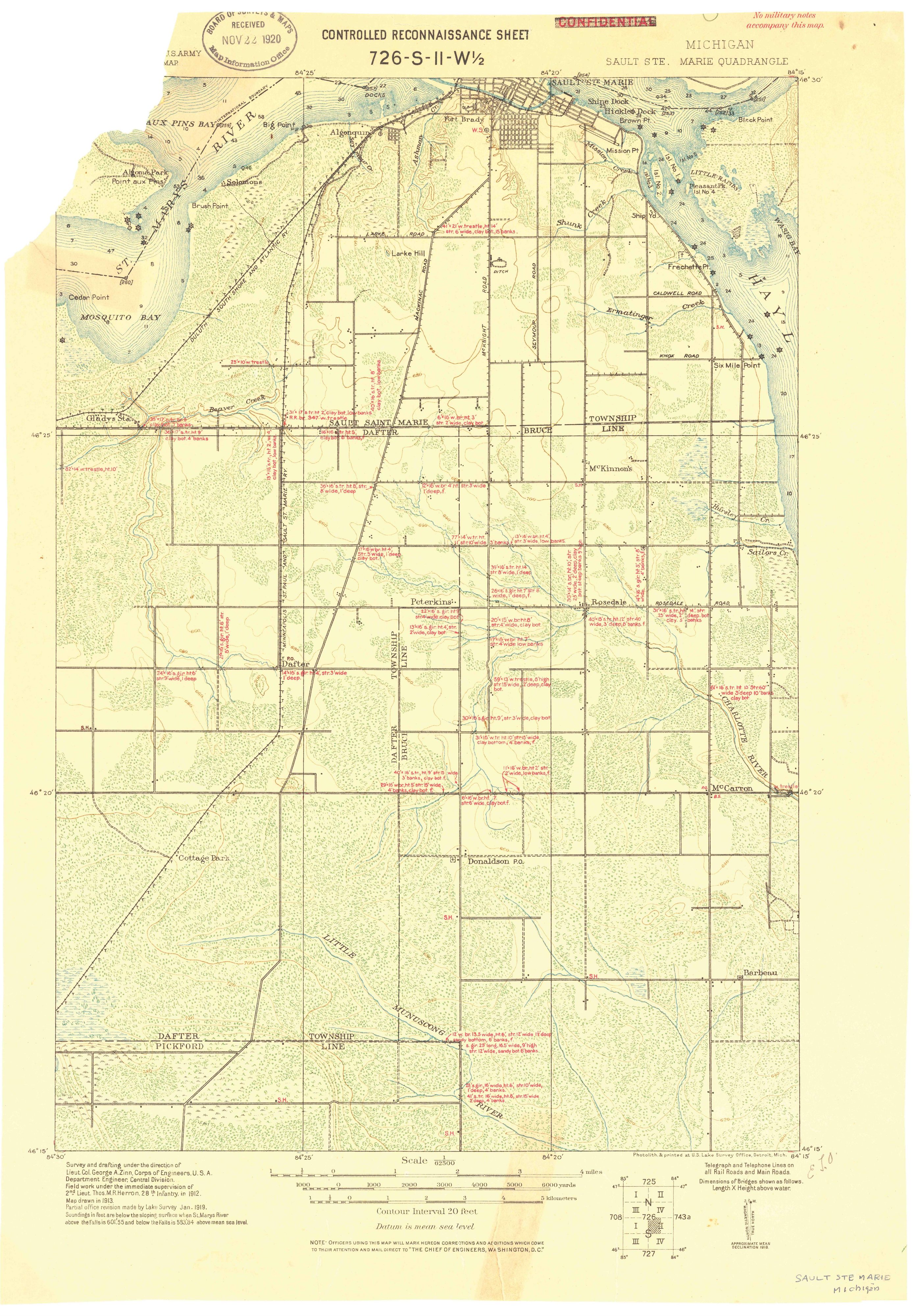
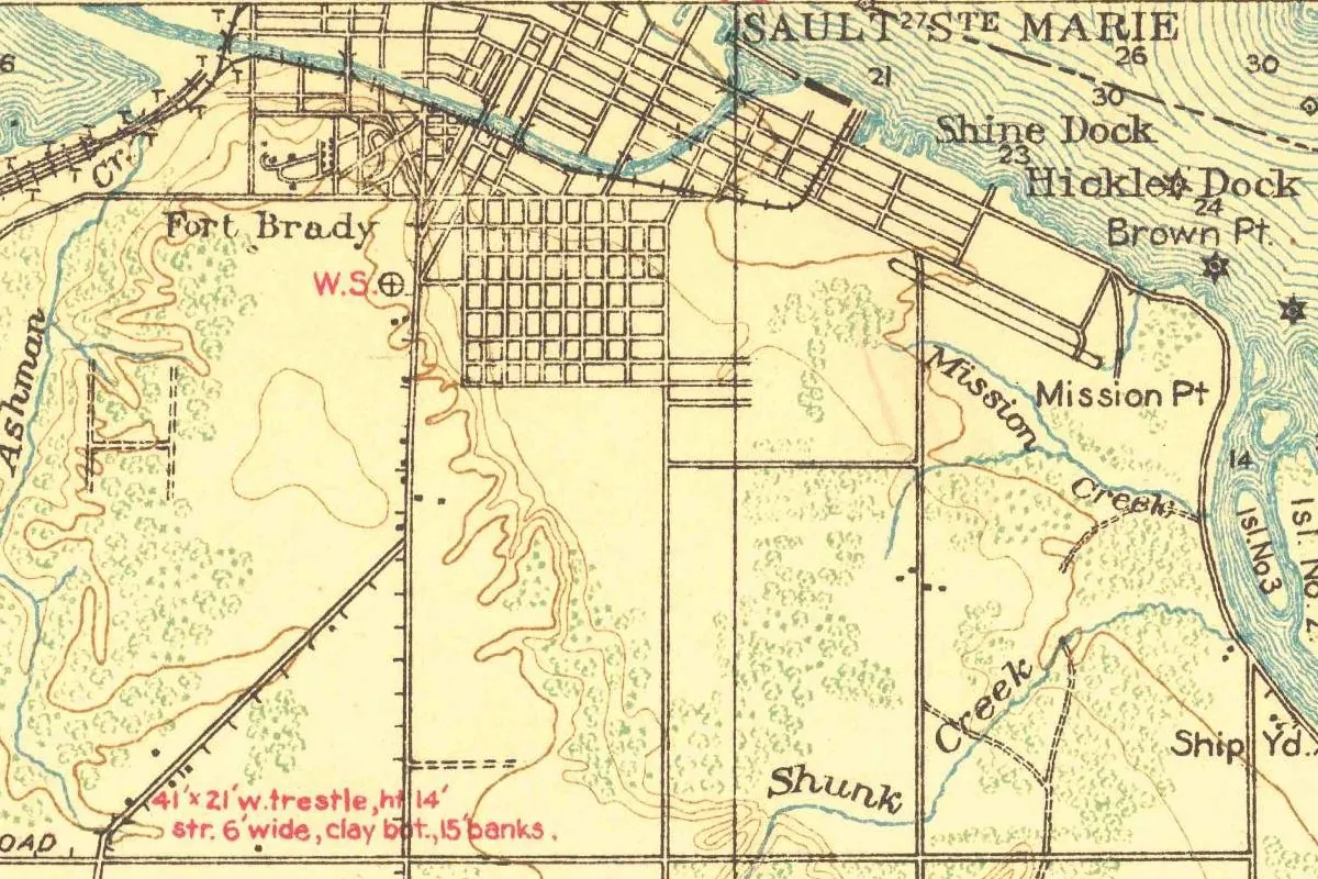
The map at the top of this page isn’t a regular Geological Survey sheet, although it’s kept in the Survey’s historical collection. It’s a U.S. Army map, “Controlled Reconnaissance Sheet 726-S-II-W½,” at 1:62,500. The margin says the field work was supervised by 2nd Lieut. Thos. M. R. Herron of the 28th Infantry “in 1912,” that the “Map drawn in 1913,” and that a “Partial office revision made by Lake Survey Jan. 1919.” It was printed at the U.S. Lake Survey Office in Detroit, and the word CONFIDENTIAL, printed in red at the top, has been crossed out. On the full sheet, the city sits against the top edge, just right of center.
In this detail, SAULT STE MARIE is lettered over the river at the top, above a street grid and the ship canal. You can pick out Fort Brady, Mission Pt and Mission Creek, Shine Dock and Hickler Dock, Brown Pt., Shunk Creek and the Ship Yd, plus depth soundings in the water.
Quick answers
What does Sault Ste. Marie mean?
Falls or rapids of St. Mary. “Sault” refers to the rapids of the St. Marys River, and “Sainte Marie” is the Virgin Mary.
How do you pronounce Sault Ste. Marie?
Soo-Saint-Mah-Ree, according to the city’s visitors bureau. Locals often just say “The Soo.”
Who named Sault Ste. Marie?
French Jesuits. The visitors bureau credits Father Jacques Marquette in 1668, and the order’s report for 1669-70 calls the mission Sainte Marie du Sault.
Key dates
- 1668Father Jacques Marquette names the settlement Sault Ste. Marie in honor of the Virgin Mary, by the visitors bureau's account.
- 1669The Jesuits' report for 1669-70 describes their permanent mission of Sainte Marie du Sault at the foot of the rapids.
- 1797The North West Company builds a small lock on the Canadian side of the river.
- 1823Control of the Sault passes to the United States after the Treaty of the Sault.
- 1855The new locks around the rapids are turned over to the state on May 31 and named the State Lock.
- 1905Henry Gannett, for the Geological Survey, glosses the name as "falls of St. Mary."
- 1919The U.S. Lake Survey partly revises the Army's 1913 reconnaissance map of Sault Ste. Marie.
Things to do in Sault Ste. Marie, Michigan
Soo Locks Park
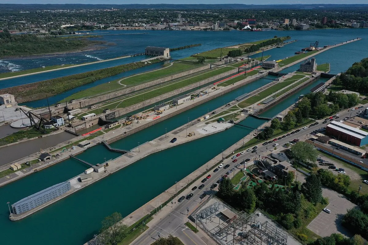
The Army Corps of Engineers park at the locks. From its raised deck in the middle, you can look down on the chambers as freighters pass, and paths lead around the grounds.
Museum Ship Valley Camp
An old Great Lakes freighter whose cargo holds now house a museum of 20,000 square feet (about 1,860 m²) and over 100 exhibits. Among them are both of the Edmund Fitzgerald's lifeboats, plus aquariums of fish from the lakes.
River of History Museum
A museum on Ashmun Street where a self-guided tour, narrated through a sound wand, takes you through the St. Marys River's thousands of years of history.
Tower of History
A 210-foot (64 m) tower built in 1968 by the Catholic Church as the Shrine of the Missionaries, with exhibits on the early missionaries and a 360-degree view over the locks and the river.
Getting there
Open Sault Ste. Marie in Google Maps
Opens in a new tab. The pin is the center of Sault Ste. Marie in the USGS place-name record.
The closest airports, Amtrak stations and intercity bus stops, measured in a straight line from the center of Sault Ste. Marie.
Airports
- Chippewa County International (CIU) Sault Ste. Marie 18 mi 29 km
- Pellston Regional/Emmet County (PLN) 67 mi 109 km
Intercity buses
- Indian Trails Sault Ste. Marie 3 mi 4 km
Distances are as the crow flies, not by road. We don't list schedules or fares because they change; check with the airline, Amtrak or the bus company before you go. Official data (FAA commercial service airports (2025), FAA airport locations, Amtrak stations and Intercity Bus Atlas) from the FAA and the U.S. Bureau of Transportation Statistics, checked Nov 18, 2026.
Sponsored
Staying in Sault Ste. Marie?
Compare hotels in Sault Ste. Marie, Michigan, on Expedia.
See hotels in Sault Ste. MarieWe may earn a commission if you buy through this link. It never changes what we write. Read our affiliate disclosure
Historical Sources & References
- The Jesuit Relations and Allied Documents, vol. 54 (1899), pp. 127-133. Dablon’s report for 1669-70: the mission of Sainte Marie du Sault, the description of the rapids and the Saulteurs. Checked against the page images.
- Henry Gannett, The Origin of Certain Place Names in the United States (1905), p. 276. “A French phrase meaning ‘falls of St. Mary.’”
- Sault Ste. Marie Convention & Visitors Bureau, “How do you say Sault Ste. Marie?” The pronunciation, Marquette in 1668, the feminine Ste., Bahweting and The Soo.
- Sault Ste. Marie Convention & Visitors Bureau, “Our Local History”. Sault du Gastogne, the meaning “jump,” the 21-foot fall, 1823, and the locks of 1797 and 1855.
- International Bridge Administration. The International Bridge between Sault Ste. Marie, Michigan, and Sault Ste. Marie, Ontario.
- National Park Service, “Jacques Marquette”. Marquette’s time as a missionary at Sault Ste. Marie.
- Soo Locks Park, Museum Ship Valley Camp, River of History Museum and Tower of History. The places listed above.
- Sault Ste. Marie’s GNIS entry, feature 637276 (U.S. Geological Survey). The city’s listing, as Sault Sainte Marie, in Chippewa County, with its coordinates.
- U.S. Army, Sault Ste. Marie reconnaissance sheet (1913, revised 1919). The 1:62,500 sheet the map at the top was cropped from.
Sponsored
Put this 1913 map on your wall
This U.S. Army reconnaissance sheet of Sault Ste. Marie, drawn in 1913 and partly revised in January 1919, is in the public domain. Download the full-size scan for free, then have it printed on canvas with CanvasOnTheCheap.
Print a map on canvasDownload the full-size mapWe may earn a commission if you buy through this link. It never changes what we write. Read our affiliate disclosure
Spot something wrong, or know more? Tell us here. You can also email us or use our contact page. Corrections are noted here with their date, never made silently.