Why Is It Called North Conway? A 1765 Charter Name
North Conway is one of five villages in the Town of Conway, which Gov. Benning Wentworth chartered in 1765 and named for Henry Seymour Conway, a British statesman later made commander in chief of the British Army. An 1889 county history quotes a writer who called Conway a champion of American liberties at the time.
North Conway, New Hampshire, is a village, not a town, named for the Town of Conway, chartered in 1765 for the British statesman Henry Seymour Conway. So if you’re asking who North Conway is named for, you’re really asking about Conway, and that answer is on paper.
Why is it called North Conway, New Hampshire?
The Town of Conway lists five villages inside its borders: Conway, North Conway, Center Conway, Redstone and Kearsarge, and it shares a sixth, Intervale, with Bartlett next door. North Conway has no government of its own. The name on the map is the town’s name with a direction in front of it.
The town and the county history give the settlement an early start. In 1766, according to the 1889 History of Carroll County, Daniel Foster, Thomas Merrill and Thomas Chadbourn “commenced the settlement of North Conway, building their dwellings on the intervale.” The town’s own history says that in 1775 voters raised small sums for two schoolhouses, one of them in North Conway. Neither source, though, says who first called the place North Conway or when the name came into use.
Conway, NH history: the 1765 charter and its namesake
The town’s website puts it plainly: in 1765, colonial Gov. Benning Wentworth granted a charter to sixty-five men for a town called “Conway,” named for Henry Seymour Conway, “who was later named Commander in Chief of the British Army.” The county history, edited by Georgia Drew Merrill, dates the charter to October 1, 1765, for 23,040 acres (about 9,300 ha), and counts sixty-nine shares rather than sixty-five men. Within five years, each grantee had to plant five acres out of every fifty he held and, if asked, hand over one ear of Indian corn every December for ten years.
Merrill’s history explains the name by quoting the travel writer M. F. Sweetser:
“The town takes its name from that gallant old English statesman, Henry Seymour Conway, Walpole’s friend, commander-in-chief of the British army, and, at the time when this mountain glen was baptized, a prominent champion of the liberties of America.”
That last part is the interesting bit. In Sweetser’s telling, a royal governor named a frontier town in 1765 for a man in London who was standing up for the colonists. Henry Gannett, in his 1905 study, describes the same man by a different title, “secretary of state of England,” in his entry for Conway, Massachusetts, though he adds that some people trace that town’s name to the town of Conway in Wales instead.
Conway wasn’t the only friend of the colonies to land on the map. In Pennsylvania, Wilkes-Barre honors two men in Parliament, John Wilkes and Isaac Barré, who spoke up for the colonies in the years before the Revolution. Wentworth himself was generous with names. He named Keene for Sir Benjamin Keene, Britain’s man in Madrid, who had tried to help him get paid for a timber shipment, and across the Connecticut River he named Bennington, Vermont, after himself in 1749.
North Conway, NH history
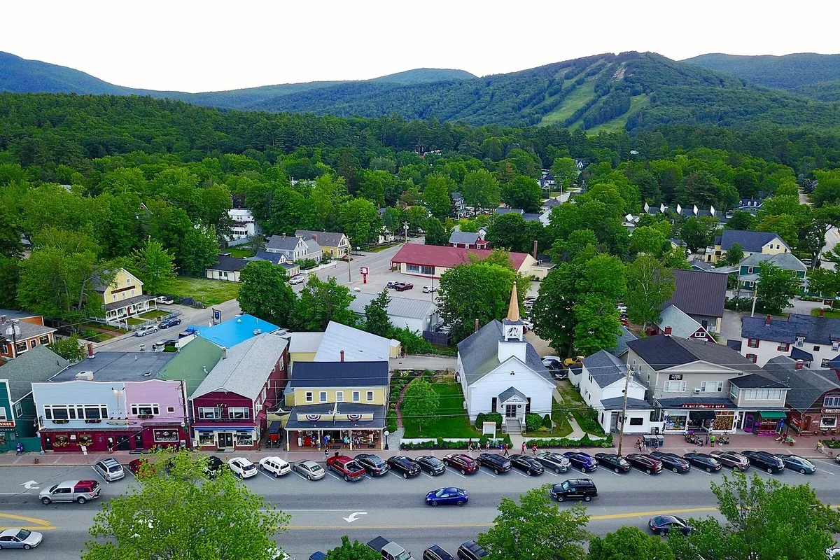
By the time Merrill’s history came out in 1889, the village had found its calling. “North Conway has a world-wide fame as the centre of White Mountain travel,” the book says, with two railroads, a park in front of the Boston and Maine station, artists’ studios and big hotels. In winter it was quiet, it adds, but in summer “it is a city of summer hotels.”
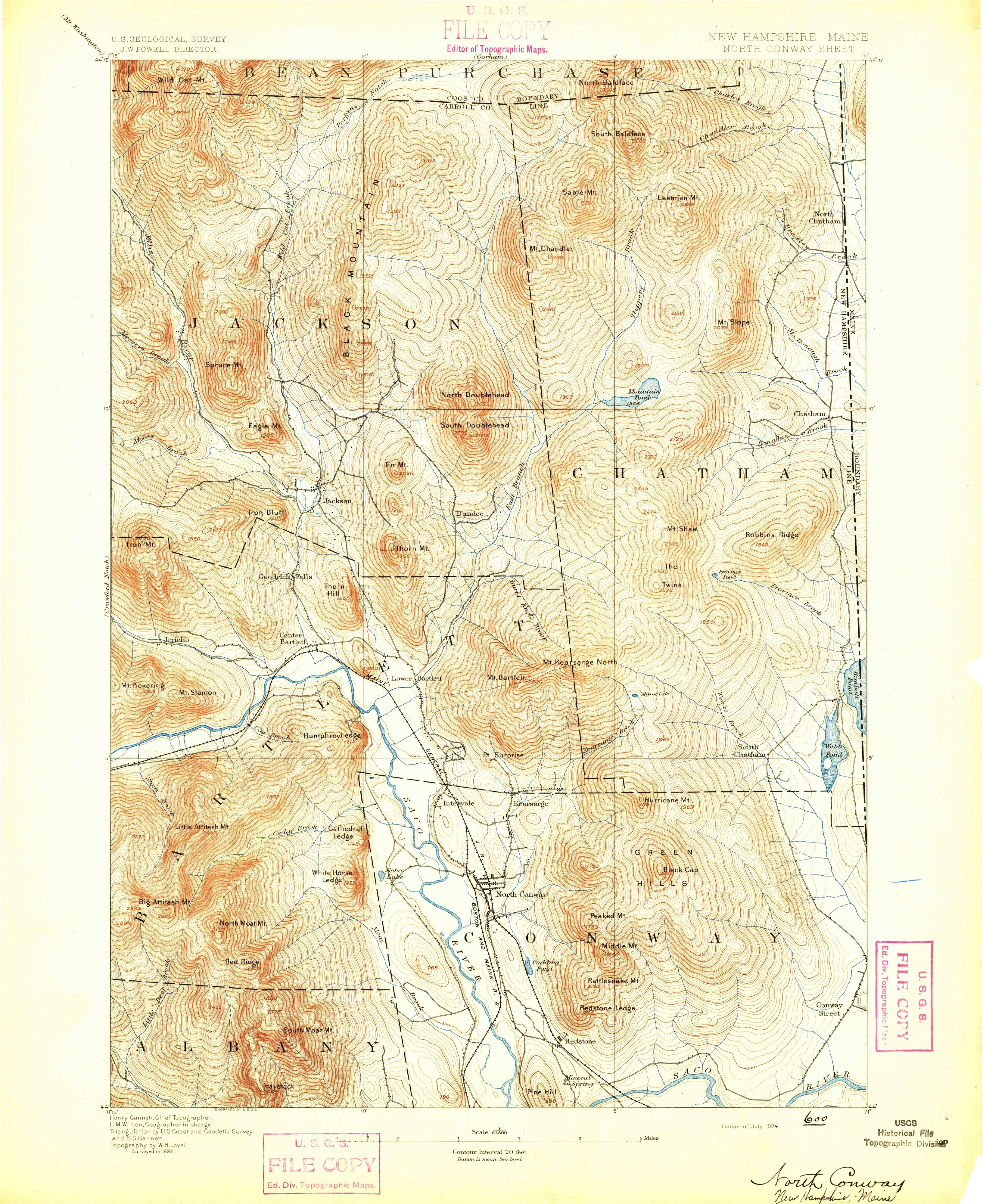
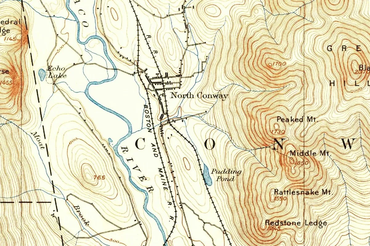
The scenery it sold is still in view. Merrill places the Green Hills and Rattlesnake, Middle and Peaked mountains in the town’s northern section, and Echo Lake with Cathedral and White Horse ledges at its northwest corner. Several of those names show up on the 1894 map at the top of this page.
North Conway on the 1894 map
The Geological Survey’s North Conway sheet, “Edition of July 1894,” was surveyed in 1892, with topography by W. H. Lovell; the margin names Henry Gannett as chief topographer. In the crop the village sits along the Boston and Maine railroad beside the Saco River, with Echo Lake to the west. Across the middle run the big spaced letters C, O, N and W, the start of the town’s name, which the mapmakers stretched over the whole township, and to the east you can read Peaked, Middle and Rattlesnake mountains, just as Merrill listed them.
Quick answers
Is North Conway, New Hampshire, a town?
No. It’s one of five villages in the Town of Conway, along with Conway, Center Conway, Redstone and Kearsarge.
Who was North Conway, New Hampshire, named after?
Henry Seymour Conway, by way of the Town of Conway: a British statesman whom the town calls a later commander in chief of the British Army and Gannett calls secretary of state. The writer M. F. Sweetser, quoted in the 1889 county history, says that when the town was named he was “a prominent champion of the liberties of America.”
When was North Conway, New Hampshire, settled?
In 1766, a year after the Conway charter of October 1, 1765, according to the 1889 county history.
Key dates
- 1765Gov. Benning Wentworth signs the charter for Conway, dated October 1.
- 1766Daniel Foster, Thomas Merrill and Thomas Chadbourn start the settlement of North Conway on the intervale, and the town's first roads are built.
- 1775The town raises money for two schoolhouses, one of them in North Conway.
- 1889A county history calls North Conway the center of White Mountain travel and a city of summer hotels.
- 1894The Geological Survey publishes its North Conway sheet.
Things to do in North Conway, New Hampshire
Conway Scenic Railroad
Heritage trains that leave from the railroad's Victorian station in North Conway Village, built in 1874 beside Schouler Park, including the Valley Train, an 11-mile (18 km) round trip to Conway that has run since 1974.
Echo Lake State Park
A state park for swimming and picnics, where a trail circles the lake and others climb toward the ledges above it.
Cathedral Ledge
A mile-long (1.6 km) auto road climbs to the top of this 700-foot (213 m) ledge, looking out over the Saco valley toward the White Mountains. It and nearby White Horse Ledge draw rock and ice climbers.
Gibson Cabin Ski Exhibit, Cranmore
A cabin on top of Cranmore Mountain, built in 1939 for Harvey Dow Gibson, that now tells the mountain's ski history, with the cabin's first stone fireplace and an old Skimobile car. You ride the scenic chairlift up.
Getting there
Open North Conway in Google Maps
Opens in a new tab. The pin is the center of North Conway in the USGS place-name record.
The closest airports, Amtrak stations and intercity bus stops, measured in a straight line from the center of North Conway.
Airports
- Portland International Jetport (PWM) 50 mi 80 km
- Portsmouth International at Pease (PSM) 69 mi 111 km
- General Edward Lawrence Logan International (BOS) Boston 117 mi 188 km
Amtrak trains
- Portland station (POR) 50 mi 80 km
- Saco station (SAO) 51 mi 83 km
Intercity buses
- Concord Coach Lines North Conway under 1 mi 0.1 km
- Greyhound Lewiston Bus Stop 45 mi 73 km
- FlixBus City of Portland 51 mi 81 km
Distances are as the crow flies, not by road. We don't list schedules or fares because they change; check with the airline, Amtrak or the bus company before you go. Official data (FAA commercial service airports (2025), FAA airport locations, Amtrak stations and Intercity Bus Atlas) from the FAA and the U.S. Bureau of Transportation Statistics, checked Nov 21, 2026.
Sponsored
Staying in North Conway?
Compare hotels in North Conway, New Hampshire, on Expedia.
See hotels in North ConwayWe may earn a commission if you buy through this link. It never changes what we write. Read our affiliate disclosure
Historical Sources & References
- Town of Conway, “About Us”. The 1765 charter for sixty-five men, the name for Henry Seymour Conway, the planting rule, the 1766 roads, the 1775 schoolhouses and the five villages.
- Georgia Drew Merrill, ed., History of Carroll County, New Hampshire (1889), pp. 816-818, 880-881. The charter of October 1, 1765, Sweetser’s explanation of the name, the sixty-nine shares, the 1766 settlement of North Conway and the “city of summer hotels.”
- Gannett, 1905, p. 90. Henry Seymour Conway as “secretary of state of England,” in the entry for Conway, Massachusetts.
- U.S. Geological Survey, GNIS feature 872395. North Conway in Carroll County.
- North Conway sheet, 1894. The sheet the map at the top was cropped from.
Sponsored
Put this 1894 map on your wall
The Geological Survey's North Conway sheet, surveyed in 1892 and published in the edition of July 1894, with the village, Echo Lake and the Saco River, is in the public domain. Download the full-size scan for free, then have it printed on canvas with CanvasOnTheCheap.
Print a map on canvasDownload the full-size mapWe may earn a commission if you buy through this link. It never changes what we write. Read our affiliate disclosure
Spot something wrong, or know more? Tell us here. You can also email us or use our contact page. Corrections are noted here with their date, never made silently.